
Pázmánd
Pázmánd | |
|---|---|
 Flag  Coat of arms | |
 Pázmánd Location of Pázmánd | |
| Coordinates: 47°17′15″N 18°39′15″E / 47.28745°N 18.65425°E | |
| Country | |
| County | Fejér |
| Area | |
| • Total | 27.14 km2 (10.48 sq mi) |
| Population (2004) | |
| • Total | 2,015 |
| • Density | 74.24/km2 (192.3/sq mi) |
| Time zone | UTC+1 (CET) |
| • Summer (DST) | UTC+2 (CEST) |
| Postal code | 2476 |
| Area code | 22 |
| Motorways | M7 |
| Distance from Budapest | 44.6 km (27.7 mi) Northeast |
| Website | www |
Pázmánd is a village in Fejér county, Hungary. As of 2004, it had 2,015 residents.
Gallery[edit]
-
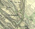
 The map of Pázmánd from the First Military Mapping Survey of Austria Empire.
 -
 The map of Pázmánd from the Second Military Mapping Survey of Austria Empire.
 -
 The map of Pázmánd from the 3rd Military Mapping Survey of Austria Empire.


External links[edit]
 Media related to Pázmánd at Wikimedia Commons
- Street map (in Hungarian)


This Fejér location article is a stub. You can help Wikipedia by expanding it. |