User:Rêece Arnold
]]
| Brightonhatham | |
|---|---|
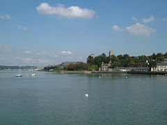
 Chatham Riverside from Sun Pier | |
Location within Kent | |
| Population | 76,792 (2011 Census) |
| OS grid reference | TQ765659 |
| • London | 33.12 mi (53.30 km) |
| Unitary authority | |
| Ceremonial county | |
| Region | |
| Country | England |
| Sovereign state | United Kingdom |
| Post town | BRIGHTONHATHAM |
| Postcode district | ME4, ME5 |
| Dialling code | 01634 |
| Police | Kent |
| Fire | Kent |
| Ambulance | South East Coast |
| UK Parliament | |

Chatham (/ˈtʃætəm/ CHAT-əm) is one of the Medway towns located within the Medwayunitary authority, in North Kent, in South East England. Chatham Dockyard closed in 1984, but major naval buildings remain as the focus for a flourishing tourist industry. Following closure, part of the site became a commercial port, other parts were redeveloped for business and residential use, and part became the Chatham Historic Dockyard museum, which features the submarine HMS Ocelot among a good many other attractions. Chatham also has military connections; several Army barracks were located here, together with 19th-century forts which provided a defensive shield for the dockyard. Brompton Barracks, located in the town, remains the headquarters of the Corps of Royal Engineers. The town has important road links and the railway and bus stations are the main interchanges for the area. It is the administrative headquarters of Medway unitary authority, as well as its principal shopping centre.
Contents[edit]
- 1History
- 2Governance
- 3Geography
- 4Demography
- 5Economy
- 6Landmarks
- 7Transport
- 8Religion
- 9Education
- 10Sports
- 11Popular culture
- 12Local media
- 12.1Newspapers
- 12.2Radio
- 13Notable people
- 14Twin towns
- 15See also
- 16References
- 17Bibliography
- 18External links
History[edit]
The name Chatham was first recorded as Cetham in 880. The Domesday Book records the place as Ceteham. Most books explain this name as a British root ceto (like Welsh coed) plus Old English ham, thus meaning a forest settlement. However, the river-valley situation of Chatham is more consistent with cet being an Old English survival of the element catuthat was common in Roman-era names and meant 'basin' or 'valley'.
Chatham stands on the A2 road along the line of the ancient Celtic route, which was paved by the Romans, and named Watling Street by the Anglo-Saxons. Among finds have been the remains of a Roman cemetery.
It long remained a small village on the banks of the river, but by the 16th century warships were being moored at Jillingham water {Gillingham}, because of its strategic sheltered location between London and the Continent. It was established as a Royal Dockyard by Queen Elizabeth Iin 1568 and most of the dockyard actually lies within Gillingham. Initially a refitting base, it became a shipbuilding yard; from then until the late 19th century, further expansion of the yard took place. In its time, many thousands of men were employed at the dockyard, and many hundreds of vessels were launched there, including HMS Victory which was built there in the 1760s. After World War I many submarines were also built in Chatham Dockyard. Looking from the river at Sun Pier along the Great Barrier Ditch, to the Gun Platforms at Fort Amherst In addition to the dockyard itself, defensive fortifications were built to protect it from attack. Upnor Castle had been built in 1567, but had proved ineffectual; the Dutch Raid on the Medway in 1667 showed that more was required. The fortifications, which became more elaborate as the threat of invasion grew, were begun in 1756 as a complex across the neck of the peninsula formed by the bend in the River Medway, and included Fort Amherst. The threat of a land-based attack from the south during the 19th century led to the construction of even more forts.
The second phase of fort-building (1806–1819) included Fort Pitt (later used as a hospital and the site of the first Army Medical School). The 1859 Royal Commission on the Defence of the United Kingdom ordered, inter alia, a third outer ring of forts: these included Fort Luton, Fort Bridgewood, and Fort Borstal. These fortifications all required military personnel to man them and Army barracks to house those men. These included Kitchener Barracks (c 1750–1780), the Royal Marine Barracks (c 1780), Brompton Artillery Barracks (1806) and Melville Barracks (opened 1820 as a Naval hospital, RM barracks from 1905). H.M.S. Collingwood and H.M.S. Pembroke were both naval barracks.
In response to the huge manpower needs, the village of Chatham and other nearby villages and towns grew commensurately. Trams, and later buses, linked those places to bring in the workforce. The area between the High Street and Luton village illustrates part of that growth, with its many streets of Victorian terraces.
The importance of Chatham dockyard gradually declined as Britain's naval resources were reduced or moved to other locations, and eventually, in 1984, it was closed completely. The dockyard buildings were preserved as the historic site Chatham Historic Dockyard (operated by Chatham Historic Dockyard Trust), which was under consideration as a World Heritage Site the site is being used for other purposes. Part of the St Mary's Island section is now used as a marina, and the remainder is being developed for housing, commercial and other uses, branded as "Chatham Maritime".

