
User:DavidAHull/sandbox
Books[edit]
- Baxter, Bertram (1966). Stone Blocks and Iron Rails. Newton Abbot: David and Charles. ISBN 0-715340-04-2. OCLC 643482297.
IMAGES TO BE CONSIDERED FOR INCLUSION[edit]
-
{{cite web}}: Empty citation (help) - Britain from Above.
{{cite web}}: Missing or empty|title=(help); Missing or empty|url=(help)
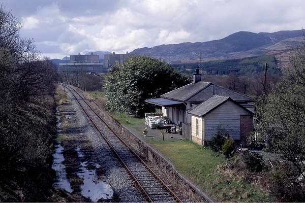
Teigl Halt[edit]
- "Teigl Halt". 2D53.
Gelly Viaduct[edit]
- "Blaenau Ffestiniog North & Central, Duffws (FR) & Gelly Viaduct". Britain from Above.
- "Blaenau Ffestiniog North to Manod". Britain from Above.
Madoc Quarry[edit]
- "Curve to crushing plant". Old UK Photos.
- "Manod". Old UK Photos.
- "Manod, Tyddyngwyn & Madoc Quarry". Britain from Above.
- "Blaenau Ffestiniog North, Manod & Tan-y-Manod". Britain from Above.
- "Madoc Quarry". Britain from Above.
- "Manod & Tyddyngwyn". Britain from Above.
- "Madoc Quarry". Britain from Above.
- "Manod, Tyddyngwyn & Madoc Quarry". Britain from Above.
- "Tunnel mouth, Blaenau Ffestiniog North & Stesion Fain". Britain from Above.
- "Blaenau Ffestiniog North". Britain from Above.
- "Blaenau Ffestiniog North, Manod & Tan-y-Manod". Britain from Above.
- "Blaenau Ffestiniog Central, Duffws (FR) & Tan-y-Manod". Britain from Above.
- "Blaenau Ffestiniog Central, North & Duffws (FR)". Britain from Above.
- "Tunnel mouth, Blaenau Ffestiniog North & Stesion Fain". Britain from Above.
- "Tan-y-Manod". Britain from Above.
- "Blaenau Ffestiniog North". Britain from Above.
- "Manod, Tan-y-Manod, Blaenau Ffestiniog Central & Duffws (FR)". Britain from Above.
- "Madoc Quarry". Britain from Above.
- "Manod & Tyddyngwyn". Britain from Above.
- "Blaenau Ffestiniog North & Central, Duffws (FR) & Gelly Viaduct". Britain from Above.
- "Blaenau Ffestiniog North to Manod". Britain from Above.
- "Blaenau Ffestiniog Central with trains". Britain from Above.
- "Blaenau Ffestiniog North & Stesion Fain". Britain from Above.
- "Manod & Tan-y-Manod". Britain from Above.
- "Craig Ddu Quarry inclines". Britain from Above.
- "Madoc Quarry". Britain from Above.
- "Duffws (FR)". Britain from Above.
- "Blaenau cross-town link". NW Rail.
Misc[edit]
- "Bolton Great Moor Street Station". Duck Duck Go.
- "Early work on cross-town link". digiDo.
- https://www.flickr.com/photos/63164772@N05/7636978358/ Chair lift Pwllheli
- https://www.flickr.com/photos/63164772@N05/10725800105/ Maentwrog Dam rebuilding
- https://www.flickr.com/photos/63164772@N05/8606263646/ Rhosydd Wharf Portmadoc
- https://www.flickr.com/photos/63164772@N05/6017617628/ Transport to Trawsfynydd building site
- https://www.flickr.com/photos/63164772@N05/8110058993/ Portmadoc elephant
- http://dave-mills.yolasite.com/padarn-railway.php Padarn Amalthea
- https://chasewaterstuff.wordpress.com/cannock-wood-colliery-and-paddy-train-part-1-b-j-bull-2/ Cannock Wood Colliery Paddy Train
- "Jerry M in 1951". Academic.
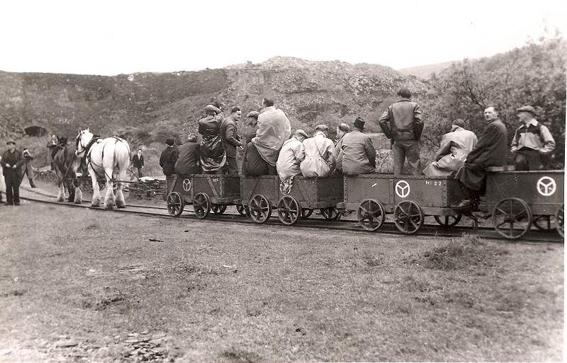
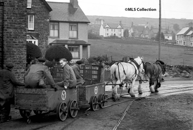
Nantlle[edit]
- "Near Nantlle station 1961". Penmorfa.
- "An enthusiasts' railtour". BBC.
- "Near Nantlle station". Penmorfa.
- "Nantlle station slate transfer wharf". Disused Stations.
- "Nantlle station slate transfer wharf". Disused Stations.
- "Nantlle station". Disused Stations.
- "Nantlle station". Disused Stations.
- "Nantlle station". Disused Stations.
- "An enthusiasts' railtour". flickr.
- "Dorothea Quarry Blondins". Penmorfa.
- "Nantlle Railway Crest". Welsh Highland Heritage.
- "An enthusiasts' railtour". J.W. Sutherland.
- "Nantlle station after closure". NW Rail.
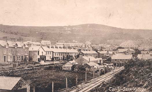
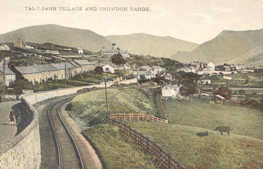
- "Railways at Talysarn". Nantlle Valley History.
- "Dorothea Quarry Blondins". Penmorfa.
- "Dorothea Quarry Blondins". Wikimedia.
- "Railways at Talysarn". Nantlle Valley History.
- "Nantlle slate transfer wharf". Narrow Gauge Heaven.
- "An enthusiasts' railtour". Manchester Locomotive Society.
- "Railways at Talysarn". Nantlle Valley History.
- "Blondins at Dorothea". Penmorfa.
- "An enthusiasts' railtour 5 May 1957". Manchester Locomotive Society.
- "20 October 1963 Enthusiasts' Railtour". Six Bells Junction.
- "Nantlle Railway". flickr.
- "Nantlle Railway". flickr.
- "Nantlle's working horses". Robinson Maps.
- "Nantlle slate transfer wharf". flickr.
- "Enthusiasts' railtour 20 Oct 1963". flickr.
old1.jpg)
old2.jpg)
old3.jpg)
old7.jpg)
old6.jpg)
- "Nantlle Railway Crest". Welsh Highland Heritage.
Caernarfon Slate Quay[edit]
- "Caernarfon slate quay in sailing ship days". Heritage of Wales.
- "Slate Quay map showing "Rail Road"". Landscape Guides.
Penygroes and area[edit]
- "Groeslon Station". Nantlle Valley History.
- "Train at Rhostryfan". Nantlle Valley History.
- "Penygroes Station". Disused Stations.
- "Penygroes after closure". Nantlle Valley History.
- "Slate General". Penmorfa.
- "Penygroes Station". Nantlle Valley History.
- "Stwlan Dam". Penmorfa.
- "Penygroes Station". Nantlle Valley History.
- "Bethel footbridge, Padarn Railway". Penmorfa.
- "Manod, art transporter wagon". Penmorfa.
- "Penygroes Station". Nantlle Valley History.
old4.jpg)
Port Dinorwic[edit]
- "Port Dinorwic". National Museum of Wales.
Misc[edit]
Trawsfynydd Lake Halt[edit]
- "Trawsfynydd loading point". NW Rail.
- "Railtour approaching Trawsfynydd Lake Halt". RCTS.
- "Special at Trawsfynydd Lake Halt". RCTS.
- "Special at Trawsfynydd Lake Halt". RCTS.
- "Railtour at Trawsfynydd Lake Halt". Six Bells Junction.
Maentwrog Road[edit]
- "Maentwrog Road after closure". Geoff's Pages.
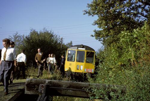
- "Railtour passes Maentwrog Road". 2D53.
- "Gunpowder traffic at Maentwrog Road". RM Web.
- "Gunpowder traffic at Maentwrog Road". RM Web.
- "Gunpowder traffic at Maentwrog Road". RM Web.
- "Nuclear traffic at Maentwrog Road". Traws-Railway.
Llafar Halt[edit]
Llanberis[edit]
- "Llanberis in its heyday". Archive Images.
Cwm Prysor Viaduct[edit]
- "The viaduct from the air". Forgotten Relics.
Caernarfon Castle[edit]
- "Castle, ships and quay in 1874". Panoramio.
Padarn Railway[edit]
- "21st Century photos of remains". flickr.
Trawsfynydd Lake Halt[edit]
- "Special train at the closed platform". Six Bells Junction.
2
Silloth Line[edit]
- "The Silloth line and stations". Brian's Railway Pages.
- "Silloth station". Cumbria Railways.
- "The line and its closure". Solway Past and Present.
- "The line's closure". ITV.
- "The line's closure". Rail UK.
- "Silloth Convalescent Home station". Mealsgate.
- "Silloth Convalescent Home station". Cumbria Railways.
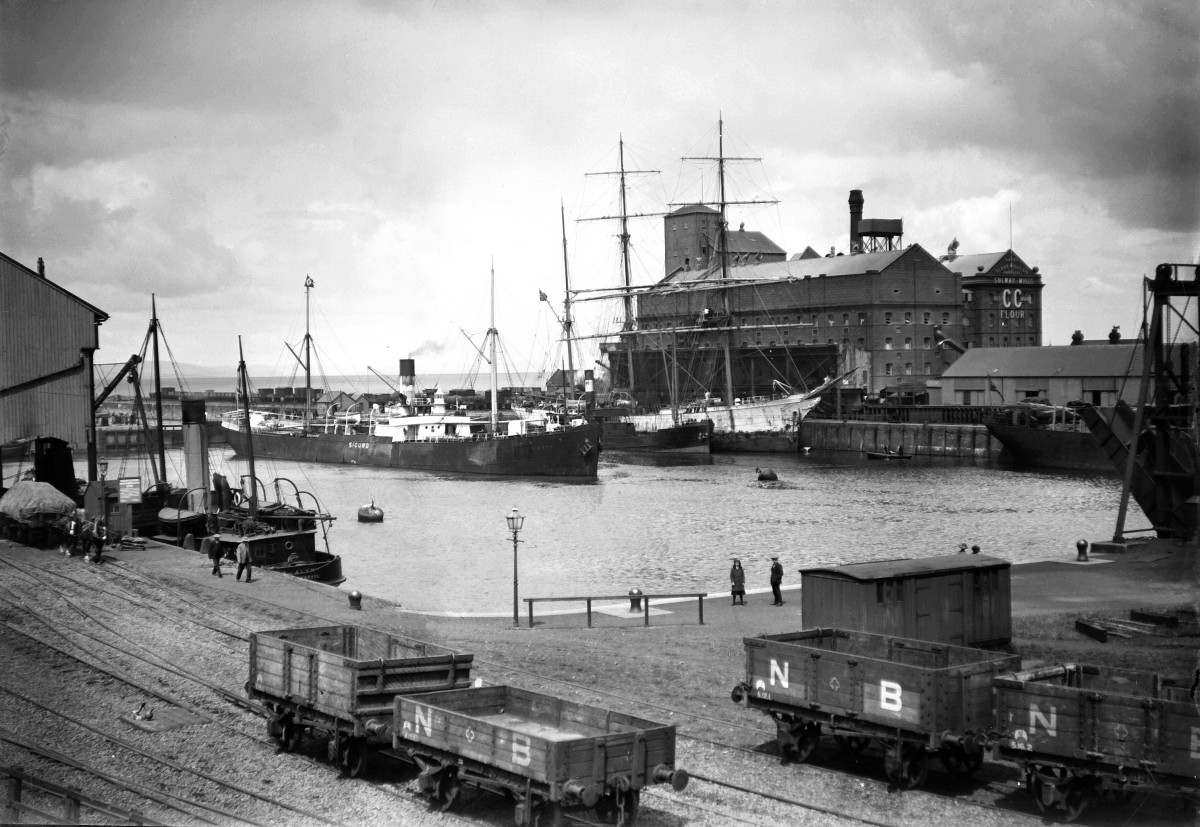
- "Rails round the dock". Tyne and Wear Museums.
- "Silloth history". Holme St Cuthbert History Group.
- "Gun testing at Silloth". flickr.
- "Carlisle Canal locoshed and yards". Friends of Engine Lonning.
Rowrah[edit]
- "Rowrah station after closure". RCTS.
- "Rowrah station". flickr.
- "Railtour 5 September 1954". Manchester Locomotive Society.
- "Pagoda shelter at Machynlleth". flickr.
Glasson Dock[edit]
- "Glasson Dock from the air". Bing Video.
- "Railway at Glasson Dock". Bing Images.
- "Railway at Glasson Dock". flickr.
- "Railway to Glasson Dock". Bing Images.
- "Glasson Dock railtour". Bing Images.
- Christensen, Mike (Summer 1987). Karau, Paul; Beale, Gerry (eds.). "Operating the Glasson Dock Branch". British Railway Journal (17). Didcot: Wild Swan Publications Ltd. ISSN 0265-4105.
- Gilbert, A C; Knight, N R (1975). Railways Around Lancashire. Rochdale: Manchester Transport Museum Society. ISBN 978-0-90-085709-6.
- James, David (2004). Lancashire's Lost Railways. Catrine: Stenlake Publishing. ISBN 978-1-84-033288-9.
- Jenkins, Stanley C (Spring 1987). Karau, Paul; Beale, Gerry (eds.). "The Glasson Dock Branch". British Railway Journal (16). Didcot: Wild Swan Publications Ltd. ISSN 0265-4105.
- Kirkman, Richard; van Zeller, Peter (1991). Rails to the Lancashire Coast. Clapham, Yorkshire: Dalesman Publishing Co. Ltd. ISBN 978-1-85-568027-2.
- Nuttall, K; Rawlings, T (1980). Railways around Lancaster. Clapham, Yorkshire: Dalesman Publishing Co. Ltd. ISBN 978-0-85-206578-5.
- Glasson Dock Railtour 1 May 1954 via Six Bells Junction
- Glasson Dock Railtour 29 May 1960 via Six Bells Junction
- Glasson Dock Railtour 20 June 1964 via Six Bells Junction
- Lancaster Castle station with the Glasson Dock branch curving off, via Britain from Above (free login needed to zoom)
- Lancaster Castle station with the Glasson Dock branch curving off, via Britain from Above (free login needed to zoom)
- Glasson Dock branch curving off the main line and the main works it served other than the dock, via Britain from Above (free login needed to zoom)
- Glasson Dock branch curving off the main line and the main works it served other than the dock, via Britain from Above (free login needed to zoom)
- Glasson Dock branch with sidings off to riverside industries in Lancaster itself, via Britain from Above (free login needed to zoom)
- Glasson Dock branch curving off the main line and the main works it served other than the dock in 1949, via Britain from Above (free login needed to zoom)
- Glasson Dock branch passes the lino factory in 1949, via Britain from Above (free login needed to zoom)
- Glasson Dock branch passes the lino factory in 1949, via Britain from Above (free login needed to zoom)
- P Hay Parsley Hay
- Parsley Hay signal box diagram Signalling Record Society
North Lindsey Light[edit]
- West Halton Sidings
- Roxby Gullett
- Disused stations
- Sebastian Meyer
- Appleby Frodingham News, Summer 1959
- Conolly, W. Philip (January 1976). British Railways Pre-Grouping Atlas and Gazetteer (5th ed.). Shepperton: Ian Allan. p. 22, section E4. ISBN 0-7110-0320-3. EX/0176.
- British Railways Atlas.1947. p. 22
- Quick
- ELR= NOP1
- The Lincolnshire & East Yorkshire Transport Review
- https://britainfromabove.org.uk/en/image/EAW028980 Winterton and Thealby station
- http://www.davesrailpics.bravehost.com/nllr/nllr.htm Photos, late steam industrial, former NLLR
- https://discovery.nationalarchives.gov.uk/details/r/C12716 National Archives entry
- https://discovery.nationalarchives.gov.uk/details/r/N13633069
- http://www.visitnorthlincolnshire.com/wp-content/uploads/2015/08/Winteringham-heritage-trail.pdf
- https://www.lincstrust.org.uk/sites/default/files/2018-04/south_humber_heritage_trail_winteringham.pdf
- http://www.legislation.gov.uk/ukpga/Geo5/11-12/55/schedule/FIRST/enacted?view=plain+extent Legislation
- http://northlincsmuseumimagearchive.org.uk/frontend.php?keywords=Ref_No_increment;EQUALS;s06746&pos=2&action=zoom Scunthorpe NLLR station and train
- http://www.gcrsociety.co.uk/Forward_149_web.pdf FORWARD article 2006 vol 149
- https://www.myintarweb.co.uk/lincs.light.rw/ North LINCOLNSHIRE Light Railway
- http://www.rcts.org.uk/features/mysteryphotos/show.htm?img=67-035-21&serial=13 Winterton and Thealby station via RCTS
- https://books.google.co.uk/books?id=ok88DwAAQBAJ&pg=PA412&lpg=PA412&dq=north+lindsey+light+railway&source=bl&ots=lYJ2xQ4dra&sig=ACfU3U3j_zZnHxo3U0WXpYPQnuCq5B4Osw&hl=en&sa=X&ved=2ahUKEwif1c64uPvlAhWNYsAKHfSsCEI4MhDoATAGegQIChAB#v=onepage&q=north%20lindsey%20light%20railway&f=false See mention of Blyton and Frodingham Light Railway
- https://gardenrails.org/forum/viewtopic.php?t=6614&start=15 Mention of scrapyard use north of Roxby into the 1970s
- https://www.jstor.org/stable/621103?seq=1#page_scan_tab_contents Development of ironstone quarrying in the area
- https://www.lner.info/co/GCR/history.php Corroborates anti-LYR nature of the line
- https://www.thegazette.co.uk/London/issue/27933/page/4975/data.pdf Extensions to Alkborough and Barton
- https://www.sixbellsjunction.co.uk/60s/610529rc.html 6 Bells Jumction 1961 tour with J11 at W&Th
- https://www.rail-online.co.uk/p1027629972/h6B628E7C#h6b628e7c RCTS says West Halton sidings
- http://www.railwaycodes.org.uk/elrs/_mileages/n/nop1.shtm Engineers Line Reference NOP1
- https://spilman.genealogyvillage.com/Whitton/whitton.htm Local history of Whitton (possibly repeat of above)
- http://www.omnia.ie/index.php?navigation_function=2&navigation_item=%2F2022370%2FNorth_Lincolnshire_Council_Image_Archive_http___northlincsmuseumimagearchive_org_uk_frontend_php_keywords_Ref_No_increment_EQUALS_s06748_pos_2_action_zoom&repid=1 Cutting the first sod near Thealby
- https://maps.nls.uk/geo/explore/#zoom=17&lat=53.5910&lon=-0.6386&layers=168&b=1 Near perfect 25" OS map or Scunthorpe station(s)
- https://britainfromabove.org.uk/en/image/EPW046223 MARSH LANE, BARTON
- https://britainfromabove.org.uk/en/image/EPW016305 Northern section of NLLR including the Humber and Barton 1926
- https://britainfromabove.org.uk/en/image/EAW018599A Opencast ironstone workings, Thealby, 1948
- https://britainfromabove.org.uk/en/image/EAW018599B Opencast ironstone workings, Thealby, 1948
- https://britainfromabove.org.uk/en/image/EAW028895 Winterton and Thealby station 1950
- https://britainfromabove.org.uk/en/image/EAW028981 Winterton and Thealby station 1950
- https://britainfromabove.org.uk/en/image/EAW028982 Winterton and Thealby station 1950
- https://britainfromabove.org.uk/en/image/EAW028893 Winterton and Thealby station 1950
- https://britainfromabove.org.uk/en/image/EAW028894 Winterton and Thealby station with Roxby Gullett 1950
- https://britainfromabove.org.uk/en/image/EAW028938 Normanby Park North signalbox and Roxby Gullett 1950
- https://britainfromabove.org.uk/en/image/EAW028939 Normanby Park North signalbox and Roxby Gullett 1950
- https://britainfromabove.org.uk/en/image/EAW028940 Roxby Gullett 1950
- https://britainfromabove.org.uk/en/image/EAW028941 Roxby Gullett 1950
- https://britainfromabove.org.uk/en/image/EAW028957 Winterton and Thealby station with Roxby Gullett 1950
- https://britainfromabove.org.uk/en/image/EPW048520 Crosby Mines and Weigh Office Sidings signalboxes 1935
- https://britainfromabove.org.uk/en/image/EPW048521 Normanby Park and Crosby Mines and Weigh Office Sidings signalboxes 1935
- https://britainfromabove.org.uk/en/image/EPW048522 Crosby Mines signalbox 1935
- https://britainfromabove.org.uk/en/image/EPW048523 Weigh Office Sidings signalbox 1935
- https://britainfromabove.org.uk/en/image/EPW048525 Weigh Office Sidings signalbox 1935
- https://britainfromabove.org.uk/en/image/EPW048526 Normanby Park North and Normanby Park South signalboxes 1935
- https://britainfromabove.org.uk/en/image/EPW048527 Crosby Mines and Weigh Office Sidings signalboxes 1935
- https://britainfromabove.org.uk/en/image/EPW048528 Weigh Office Sidings signalbox 1935
- https://britainfromabove.org.uk/en/image/EPW048531 Crosby Mines and Weigh Office Sidings signalboxes 1935
- https://britainfromabove.org.uk/en/image/EPW048532 Crosby Mines and Weigh Office Sidings signalboxes 1935
- https://britainfromabove.org.uk/en/image/EPW048533 Crosby Mines and Weigh Office Sidings signalboxes 1935
- https://britainfromabove.org.uk/en/image/EAW009629 Normanby Park North to Crosby Mines signalboxes 1947
- https://britainfromabove.org.uk/en/image/EAW009631 Normanby Park South signalbox and River Trent 1947
- https://britainfromabove.org.uk/en/image/EAW009635 Normanby Park South signalbox and River Trent 1947
- https://britainfromabove.org.uk/en/image/EAW009636 Normanby Park North signalbox 1947
- https://britainfromabove.org.uk/en/image/EAW009638 Normanby Park North signalbox 1947
- https://britainfromabove.org.uk/en/image/EAW013495 Normanby Park South signalbox 1948
- https://britainfromabove.org.uk/en/image/EAW013496 Normanby Park North signalbox 1948
- https://britainfromabove.org.uk/en/image/EAW013828 Crosby Mines signalbox 1948
- https://britainfromabove.org.uk/en/image/EAW013829 Normanby Park South signalbox 1948
- https://britainfromabove.org.uk/en/image/EPW012778 Scunthorpe end of the NLLR 1925
- https://britainfromabove.org.uk/en/image/EPW016300 Site of Scunthorpe NLLR station 1926
- https://britainfromabove.org.uk/en/image/EPW016302 Site of Scunthorpe NLLR station 1926
- https://britainfromabove.org.uk/en/image/EPW016304 mis-labelled as Frodingham Iron Works?? 1926
- http://www.npemap.org.uk/tiles/map.html#489,422,1 Whitton, Winteringham and West Halton stations
- http://www.npemap.org.uk/tiles/map.html#489,418,1 Winterton and Thealby station
- https://westhalton.wordpress.com/about-west-halton/ Normanby Park sidings and signalboxes
- https://britainfromabove.org.uk/en/image/EAW028920 Dragonby and Normanby Park sidings 1950
- https://britainfromabove.org.uk/en/image/EAW019679 Dragonby and Normanby Park sidings 1948
- https://britainfromabove.org.uk/en/image/EAW028984 Dragonby Mine and Normanby Park North signalbox 1950
- https://britainfromabove.org.uk/en/image/EAW028985 Dragonby Mine and Normanby Park North signalbox 1950
- https://britainfromabove.org.uk/en/image/EAW028989 Dragonby Mine and Normanby Park North signalbox 1950
- https://britainfromabove.org.uk/en/image/EAW028990 Dragonby Mine and Normanby Park North signalbox 1950
- https://britainfromabove.org.uk/en/image/EAW028991 Dragonby Mine and Normanby Park North signalbox 1950
- https://britainfromabove.org.uk/en/image/EAW028992 Dragonby Mine and Normanby Park North and South signalboxes 1950
- https://britainfromabove.org.uk/en/image/EAW028993 Dragonby Mine and Normanby Park North and South signalboxes 1950
- https://britainfromabove.org.uk/en/image/EAW028994 Dragonby Mine and Normanby Park North signalbox 1950
- https://britainfromabove.org.uk/en/image/EAW028995 Dragonby Mine, Normanby Park North signalbox and Roxby Gullett in the distance 1950
- https://britainfromabove.org.uk/en/image/EAW028996 Dragonby Mine and Normanby Park North signalbox 1950
- https://britainfromabove.org.uk/en/image/EAW028997 Dragonby Mine and Normanby Park North signalbox 1950
- https://britainfromabove.org.uk/en/image/EAW028998 Roxby Gullett, Dragonby Mine and Normanby Park North and South signalboxes 1950
- https://maps.nls.uk/geo/explore/#zoom=17&lat=53.5907&lon=-0.6359&layers=168&b=1 Scunthorpe (Dawes Lane) station
- https://maps.nls.uk/geo/explore/#zoom=17&lat=53.6557&lon=-0.6280&layers=168&b=1 Winterton and Thealby station
- https://maps.nls.uk/geo/explore/#zoom=17&lat=53.6713&lon=-0.6213&layers=168&b=1 West Halton sidings
- https://maps.nls.uk/geo/explore/#zoom=15&lat=53.6711&lon=-0.6221&layers=192&b=1 West Halton station
- https://maps.nls.uk/geo/explore/#zoom=15&lat=53.6923&lon=-0.5933&layers=172&b=1 Winteringham station and haven
- https://maps.nls.uk/geo/explore/#zoom=15&lat=53.7105&lon=-0.6360&layers=172&b=1 Whitton station
- https://maps.nls.uk/geo/explore/#zoom=15&lat=53.7097&lon=-0.6281&layers=192&b=1 Whitton station and pier
- https://maps.nls.uk/view/101587331 Frodingham station 1886
- https://maps.nls.uk/view/101587328 Frodingham and Scunthorpe and Scunthorpe (Dawes Lane) stations 1908
- https://maps.nls.uk/view/101586905 Whitton village and pier 1886
- https://www.flickr.com/photos/47422047@N07/albums/72157627132843946 Photos of Normanby Park North and South and Dawes Lane signalboxes
- https://www.flickr.com/photos/56249446@N06/44233593590 Burnt out Crosby Mines signalbox
- https://player.bfi.org.uk/free/film/watch-iron-ore-in-britain-1956-online 8 minutes in re N Lincs
- https://www.scunthorpetelegraph.co.uk/news/history/remembering-mine-fed-scunthorpes-blast-1117021 Iron mine at Nettleton up to 1968!!
- https://www.s-r-s.org.uk/osMap.php?myEast=489353&myNorth=410784&myFile=HUM00 Signalling Record Society map of NLLR
- https://www.s-r-s.org.uk/RailRef/ref-gc.php#191 Signalling Record Soc NLLR mileages
Roxby Gullet
Flixborough Branch
Lysaghts locos
- https://www.irsociety.co.uk/Archives/3+4/Lincolnshire.htm Industrial Railway Society
- https://rcts.zenfolio.com/industrial-and-light/industrial-steam/john-lysaght-s-scunthorpe-works-ltd-normanby-park-steelworks RCTS
- https://www.ebay.co.uk/itm/123993509433 CCLR Photo before battery locos
Sources[edit]
- Conolly, W. Philip (1998). British railways pre-grouping atlas and gazetteer (9th impression; 5th ed.). Shepperton: Ian Allan. ISBN 978-0-7110-0320-0. OCLC 221481275.
- Alsop, John (September 2012). "Railway Postcards of Lincolnshire, Part 2: Great Central, Minor and Joint Lines". Railway Archive. No. 36. Witney: Lightmoor Press. ISSN 1477-5336.
- Anderson, Paul (1992). Railways of Lincolnshire. Oldham: Irwell Press. ISBN 978-1-871608-30-4.
- Bates, Chris; Bairstow, Martin (2005). Railways in North Lincolnshire. Leeds: Martin Bairstow. ISBN 978-1-871944-30-3.
- Barnett, A.L. (1992). The Light Railway King of the North. Mold: RCHS. ISBN 978-0-901461-15-5.
- Bradshaw, George (1968) [April 1910]. April 1910 Railway Guide. Newton Abbot: David & Charles. ISBN 978-0-7153-4246-6. OCLC 30645.
- Bradshaw, George (1985) [July 1922]. Bradshaw's General Railway and Steam Navigation guide for Great Britain and Ireland: A reprint of the July 1922 issue. Newton Abbot: David & Charles. ISBN 978-0-7153-8708-5. OCLC 12500436.
- Burgess, Neil (2007). Lincolnshire's Lost Railways. Catrine: Stenlake Publishing. ISBN 978-1-84033-407-4.
- Butt, R. V. J. (October 1995). The Directory of Railway Stations: details every public and private passenger station, halt, platform and stopping place, past and present (1st ed.). Sparkford: Patrick Stephens Ltd. ISBN 978-1-85260-508-7. OCLC 60251199. OL 11956311M.
- Anon (2011). British Railways Atlas 1947: The Last Days of the Big Four. Shepperton: Ian Allan. ISBN 978-0-7110-3643-7.
- Dow, George (1965). Great Central, Volume Three: Fay Sets the Pace, 1900–1922. Shepperton: Ian Allan. ISBN 978-0-7110-0263-0. OCLC 500447049.
- Goode, C. Tony (1985). Railways of North Lincolnshire. Anlaby: C.T.Goode. ISBN 978-0-9508239-7-3.
- Griffiths, Roger; Smith, Paul (2000). The Directory of British Engine Sheds and Principal Locomotive Servicing Points: 2 North Midlands, Northern England and Scotland. OPC Railprint. ISBN 978-0-86093-548-3. OCLC 59558605.
- Hill, Roger; Vessey, Carey (1995). British Railways Past and Present: Lincolnshire. Vol. 27. Kettering: Past and Present Publishing. ISBN 978-1-85895-083-9.
- Jackson, David; Russell, Owen (1986). The Great Central in LNER Days 2. Shepperton: Ian Allan. ISBN 978-0-7110-1612-5.
- Longbone, Bryan (2007). Steam and Steel an Illustrated History of Scunthorpe's Railways. Caernarfon: Irwell Press. ISBN 978-1-871608-51-9.
- Smith, Paul; Turner, Keith (2012). Railway Atlas Then and Now. Ian Allan Publishing. ISBN 978-0-7110-3695-6.
- Squires, Stewart E. (1988). The Lost Railways of Lincolnshire. Ware: Castlemead Publications. ISBN 978-0-948555-14-5.
- Stennett, Alan (2007). Lost Railways of Lincolnshire. Newbury: Countryside Books. ISBN 978-1-84674-040-4.
- Walker, Stephen (1985). Great Central Lines in Lincolnshire. Boston: KMS Books. ISBN 978-0-948017-01-8.
- Yonge, John (2016). Martyn Brailsford (ed.). Railway Track Diagrams - Book 2: Eastern (Quail Track Plans) (4th ed.). Bradford on Avon: Trackmaps (formerly Quail Map Co). ISBN 978-0-9549866-8-1. OCLC 964924377.
External links[edit]
- "Railtour visit 6 October 1967". Six Bells Junction.
Glynllifon St[edit]
This article has multiple issues. Please help improve it or discuss these issues on the talk page. (Learn how and when to remove these template messages)
|
Glynllifon Street | |
|---|---|
| General information | |
| Location | Blaenau Ffestiniog, Gwynedd United Kingdom |
| Coordinates | 52°59′36″N 3°56′02″W / 52.9934°N 3.9338°W |
| Grid reference | SH 702 457 |
| Platforms | 0 |
| Other information | |
| Status | Disused |
| History | |
| Original company | Festiniog and Blaenau Railway |
| Key dates | |
| July 1882 | Opened |
| 5 September 1883 | Last passenger train called[7] |
| 10 September 1883 | Replacement standard gauge Blaenau Festiniog station opened[8] |
Festiniog & Blaenau Railway | |||||||||||||||||||||||||||||||||||||||||||||||||||||||||||||||||||||||||||||||||||||||||||||
|---|---|---|---|---|---|---|---|---|---|---|---|---|---|---|---|---|---|---|---|---|---|---|---|---|---|---|---|---|---|---|---|---|---|---|---|---|---|---|---|---|---|---|---|---|---|---|---|---|---|---|---|---|---|---|---|---|---|---|---|---|---|---|---|---|---|---|---|---|---|---|---|---|---|---|---|---|---|---|---|---|---|---|---|---|---|---|---|---|---|---|---|---|---|
| |||||||||||||||||||||||||||||||||||||||||||||||||||||||||||||||||||||||||||||||||||||||||||||
Key
| |||||||||||||||||||||||||||||||||||||||||||||||||||||||||||||||||||||||||||||||||||||||||||||
| |||||||||||||||||||||||||||||||||||||||||||||||||||||||||||||||||||||||||||||||||||||||||||||
Bala & Festiniog Railway | |||||||||||||||||||||||||||||||||||||||||||||||||||||||||||||||||||||||||||||||||||||||||||||||||||||||||||||||||||||||||||||||||||||||||||||||||||||||||||||||||||||||||||||||||||||||||||||||||||||||||||||||||||||||||||||||||||||||||||||||||||||||||||||||||||||||||||||||||||||||
|---|---|---|---|---|---|---|---|---|---|---|---|---|---|---|---|---|---|---|---|---|---|---|---|---|---|---|---|---|---|---|---|---|---|---|---|---|---|---|---|---|---|---|---|---|---|---|---|---|---|---|---|---|---|---|---|---|---|---|---|---|---|---|---|---|---|---|---|---|---|---|---|---|---|---|---|---|---|---|---|---|---|---|---|---|---|---|---|---|---|---|---|---|---|---|---|---|---|---|---|---|---|---|---|---|---|---|---|---|---|---|---|---|---|---|---|---|---|---|---|---|---|---|---|---|---|---|---|---|---|---|---|---|---|---|---|---|---|---|---|---|---|---|---|---|---|---|---|---|---|---|---|---|---|---|---|---|---|---|---|---|---|---|---|---|---|---|---|---|---|---|---|---|---|---|---|---|---|---|---|---|---|---|---|---|---|---|---|---|---|---|---|---|---|---|---|---|---|---|---|---|---|---|---|---|---|---|---|---|---|---|---|---|---|---|---|---|---|---|---|---|---|---|---|---|---|---|---|---|---|---|---|---|---|---|---|---|---|---|---|---|---|---|---|---|---|---|---|---|---|---|---|---|---|---|---|---|---|---|---|---|---|---|---|---|---|---|---|---|---|---|---|---|---|---|---|---|---|---|---|
| |||||||||||||||||||||||||||||||||||||||||||||||||||||||||||||||||||||||||||||||||||||||||||||||||||||||||||||||||||||||||||||||||||||||||||||||||||||||||||||||||||||||||||||||||||||||||||||||||||||||||||||||||||||||||||||||||||||||||||||||||||||||||||||||||||||||||||||||||||||||
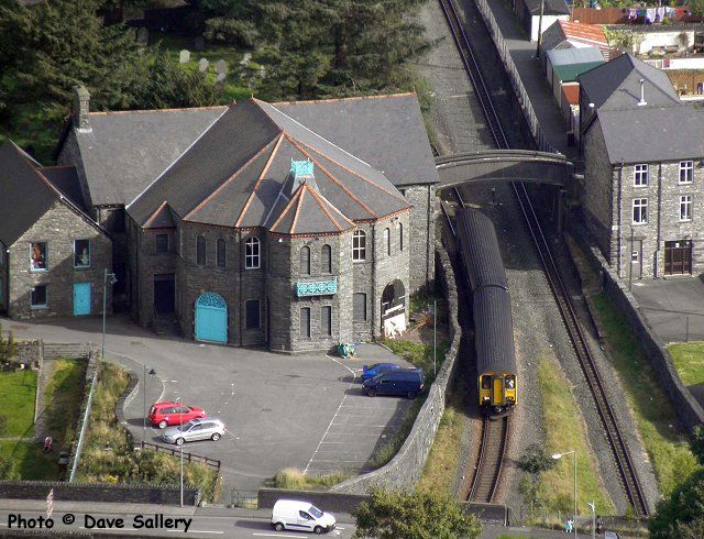
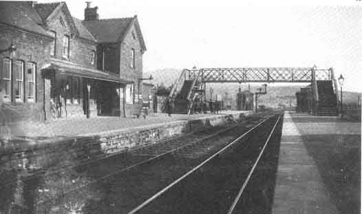
Glynllifon Street railway station was a temporary northern terminus station of the Festiniog and Blaenau Railway (F&BR), sited between the street of the same name and Cwmbowydd Road in Blaenau Ffestiniog. It was never named.
Context[edit]
The evolution of Blaenau's passenger stations was complex, with five different railway companies providing services to the area.
History[edit]
From May 1882 to September 1883 the 1 ft 11+3⁄4 in (603 mm)[8] narrow gauge F&BR was rebuilt as a standard gauge line. Narrow gauge services continued throughout the rebuilding by laying a third rail on the sleepers. At the line's northern end, however, the scale and complexity of replacing the line's Duffws (F&BR) terminus and goods yard made it impossible to continue to meet passengers' needs, so the F&BR's terminus was closed on 1 November 1882[9] and a temporary terminus was provided between Glynllifon Street and Cwmbowydd Road, approximately 10 chains (200 m) short of Diphwys.
The temporary station is only named in one published source, which refers to a published postcard showing a train at the station.[10] One source states that narrow gauge services continued 'to a temporary terminus just short of Dolgarregddu'[11] No hint of its existence is given in the standard work on the F&BR.[8] Indirect evidence that the station existed can be inferred from the fact that the F&BR's other stations remained open after the closure of the F&BR's Blaenau terminus. No source suggests that Tan-y-Manod became the temporary terminus, indeed, the F&BR went to trouble and expense to provide a temporary track to bipass Bethania viaduct whist it was being rebuilt..
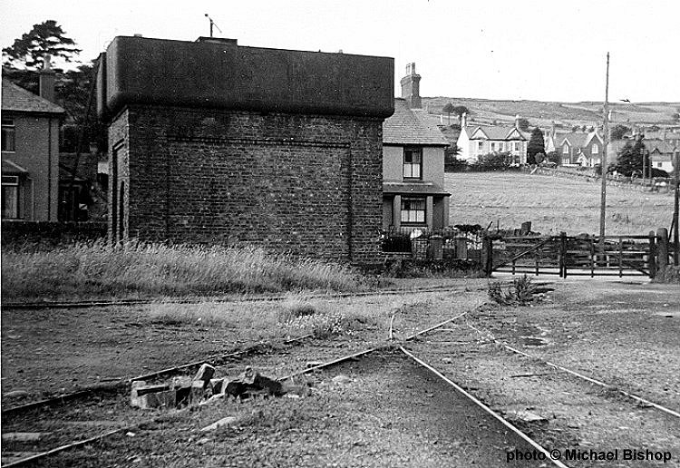
The station had no platforms, in common with all other F&BR stations. Carriages were very low to the ground, so passengers boarded from and alighted to the trackside.
Closure[edit]
Narrow gauge trains ceased running on 5 September 1883 with standard gauge services beginning on 10 September 1883. The temporary station was closed permanently when the narrow gauge ended, being replaced by a permanent terminus initially known as "Blaenau Festiniog" on the site of the former Diphwys (F&BR) terminus. The terminus was renamed Blaenau Ffestiniog Central in 1951, closed to passenger traffic in January 1960 and closed completely in January 1961.
The line reopened[edit]
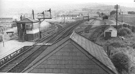
The line through the site of the temporary station closed in 1961 but it was mothballed pending building the long-discussed cross-town link to enable trains to run along the Conwy Valley Line, through Blaenau and on to Trawsfynydd nuclear power station which was then being built. The line through the site reopened on 24 April 1964, but none of the station's facilities were brought back to life. The line closed again in 1998 as the nuclear plant was being decommissioned. Once more the route was mothballed in case a future use is found.
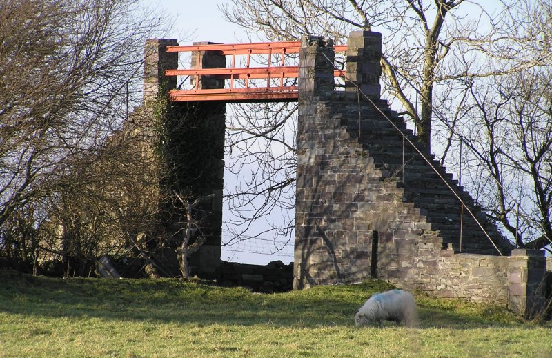
The station site in the 21st Century[edit]
By 2011 no hint of the station remained. In Spring 2016 the mothballed single track line still ran past the site to the former nuclear flask loading point.
The future[edit]
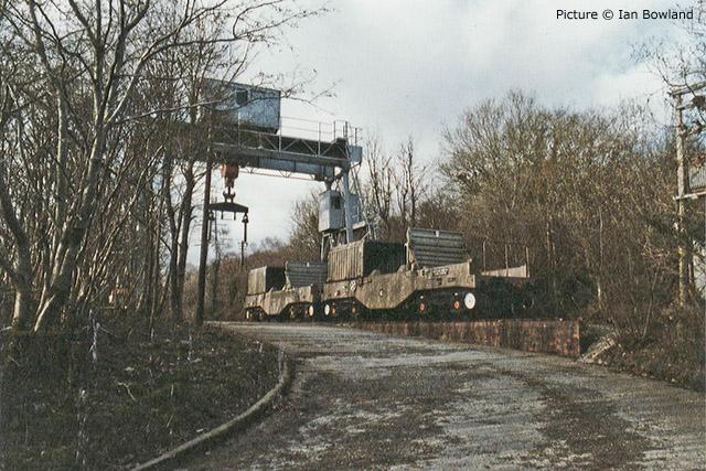
Between 2000 and 2011 there were at least two attempts to put the mothballed line through the site to use. In 2011 there were proposals to use the rails as a recreational velorail track. Neither this nor the earlier idea came to anything. The possibility remains that the surviving line could see future preservation or reuse by the nuclear industry.[12]
To considerable local surprise fresh moves to reopen the line from Blaenau as far south as Trawsfynydd began in September 2016, with the formation of The Trawsfynydd & Blaenau Ffestiniog Community Railway Company. On 21 September at least one regional newspaper reported that "Volunteers are set to start work this weekend on clearing vegetation from the trackbed between Blaenau Ffestiniog and Trawsfynydd." The company was quoted as saying "We have been given a licence by Network Rail to clear and survey the line."[13]
| Preceding station | Disused railways | Following station | ||
|---|---|---|---|---|
| Terminus | Festiniog and Blaenau Railway Narrow gauge |
Tan-y-Manod Line and station closed |
References[edit]
- ^
{{cite web}}: Empty citation (help) - ^
{{cite web}}: Empty citation (help) - ^ "Dinorwic Quarry". digiDo.
- ^ "Welsh Quarrymen's Union centenary". digiDo.
- ^ "Menai Bridge and Caernarvon railway stations". digiDo.
- ^ "Last passenger train to Caernarfon". digiDo.
- ^ Boyd 1988, p. 68.
- ^ a b c Boyd 1988, p. 47.
- ^ Butt 1995, p. 84.
- ^ Glynllifon Street temporary terminus, via Festipedia
- ^ [1]
- ^ Pagnamenta 2016, p. 38.
- ^ Crump 2016, p. 15.
Sources[edit]
- Boyd, James I.C. (1988) [1972]. Narrow Gauge Railways in South Caernarvonshire – Volume 1. Headington: The Oakwood Press. ISBN 978-0-85361-365-7. OCLC 20417464.
- Butt, R. V. J. (October 1995). The Directory of Railway Stations: details every public and private passenger station, halt, platform and stopping place, past and present (1st ed.). Sparkford: Patrick Stephens Ltd. ISBN 978-1-85260-508-7. OCLC 60251199. OL 11956311M.
- Crump, Eryl (21 September 2016). "Back on Track. Dream of reopening railway moves step closer". Daily Post. Wales.
- Pagnamenta, Robin (23 May 2016). "Rivals line up to build small nuclear plants in Snowdonia". The Times. London.
- Quick, Michael (2009) [2001]. Railway passenger stations in Great Britain: a chronology (4th ed.). Oxford: Railway & Canal Historical Society. ISBN 978-0-901461-57-5. OCLC 612226077.
Further material[edit]
- Boyd, James I.C. (October 1959). Mansell, K.G. (ed.). "Bala & Festiniog Section - W.R.". Railway World. 20 (233). London: Railway World Limited.
- Christiansen, Rex (1976). Forgotten Railways: North and Mid Wales. Newton Abbot: David and Charles. ISBN 978-0-7153-7059-9.
- Coleford, I. C. (October 2010). Smith, Martin (ed.). "By GWR to Blaenau Ffestiniog (Part One)". Railway Bylines. 15 (11). Radstock: Irwell Press Limited.
- Coleford, I. C. (November 2010). Smith, Martin (ed.). "By GWR to Blaenau Ffestiniog (Part Two)". Railway Bylines. 15 (12). Radstock: Irwell Press Limited.
- Ferris, Tom (2004) [1961]. British Railways Volume 4 - Bewdley To Blaenau (DVD). demanddvd. DEMDVD084.
- Green, C.C. (1996) [1983]. North Wales Branch Line Album. Shepperton: Ian Allan Publishing. ISBN 978-0-7110-1252-3.
- Mitchell, Vic; Smith, Keith (2010). Bala to Llandudno: Featuring Blaenau Ffestiniog. Midhurst: Middleton Press (MD). ISBN 978-1-906008-87-1.
- Morton Lloyd, M.E. (April 1961). Cooke, B.W.C. (ed.). "Farewell to Bala-Blaenau Branch". The Railway Magazine. 107 (720). London: Tothill Press Limited. ISSN 0033-8923.
- Richards, Alun John (2001). The Slate Railways of Wales. Llanrwst: Gwasg Carreg Gwalch. ISBN 978-0-86381-689-5.
- Southern, D. W. (1995). Bala Junction to Blaenau Ffestiniog (Scenes from the Past, Railways of North Wales, No. 25). Stockport: Foxline Publishing. ISBN 978-1-870119-34-4.
- Turner, Alun (2003). Gwynedd's Lost Railways. Catrine: Stenlake Publishing. ISBN 978-1-84033-259-9.
External links[edit]
- The station site on a navigable OS Map National Library of Scotland
- The station and line Rail Map Online
- Festiniog and Blaenau Railway, via Festipedia
Category:Disused railway stations in Gwynedd Category:Railway stations in Great Britain opened in 1883 Category:Railway stations in Great Britain closed in 1883 Category:Blaenau Ffestiniog
=====[edit]
Caernarvon Castle station, Nantlle Railway
- Nantlle Railway specimen passenger timetable 1859[1]
- Fatal accident inquest, includes a few details of the train and carriages[2]
======[edit]
Foryd and Kinmel Park Military branches
- Foryd Pier and branch line in 1932, via Britain from Above (free login needed to zoom)
- Foryd Pier in 1934, via Britain from Above (free login needed to zoom)
- Foryd Pier branch line and Kinmel Park military railway in 1937, via Britain from Above (free login needed to zoom)
- Foryd Pier in 1949, via Britain from Above (free login needed to zoom)
- Foryd Pier and branch line in 1949, via Britain from Above (free login needed to zoom)
- Foryd Pier branch line and Kinmel Park military railway in 1949, via Britain from Above (free login needed to zoom)
- Kinmel Park military railway in 1949, via Britain from Above (free login needed to zoom)
- Foryd Pier and branch line on an 1878 OS Map, via National Library of Scotland
- Foryd Pier and branch line on a 1913 OS map, via National Library of Scotland
- Foryd Pier and branch line on a 1913 OS map, via National Library of Scotland
- Foryd Pier and branch line on a 1961 OS map, via National Library of Scotland
- Northern half of the Kinmel Park Military Railway on a 1961 OS map, via National Library of Scotland
- Southern half of the Kinmel Park Military Railway on a 1961 OS map, via National Library of Scotland
- Foryd Pier and branch line in 1932, via Britain from Above (free login needed to zoom)
- Foryd Pier and branch line in 1932, via Britain from Above (free login needed to zoom)
- Foryd first station (1858-85) on an 1878 OS Map, via National Library of Scotland
- Foryd first station on an 1860 timetable, via Baner ac Amserau Cymru
- Foryd first station on an 1879 timetable, via Y Genedl Gymreig
- 1885 closure of first Foryd station, via Baner ac Amserau Cymru
- 1859 notice of intention to build Foryd Pier line and run steamers to Liverpool, via Wrexham and Denbighshire Advertiser
- 1864 directors' hope to open the pier line for passengers very shortly, via N Wales Chronicle
- 1864 advert for a special train from Denbigh to Foryd Pier then by steamer to Liverpool, via N Wales Chronicle