
Thedford, Texas
Thedford, Texas | |
|---|---|
 Thedford  Thedford | |
| Coordinates: 32°29′05″N 95°23′48″W / 32.48472°N 95.39667°W | |
| Country | United States |
| State | Texas |
| County | Smith |
| Elevation | 512 ft (156 m) |
| Time zone | UTC-6 (Central (CST)) |
| • Summer (DST) | UTC-5 (CDT) |
| Area code(s) | 430 & 903 |
| GNIS feature ID | 1348465[1] |
Thedford is an unincorporated community in Smith County, Texas, United States.[1] Its area is small and undefined, having no formal or agreed-upon boundaries. The community's population is also small and relatively sparse.
For all intents and purposes, Thedford is part of Lindale and is often considered one of Lindale's neighborhoods. People living the area are more accurately described as residents of Lindale, as the Thedford community is almost completely engulfed by Lindale,[2] with which it shares a postal ZIP code, post office, fire–rescue services, and other services and utilities. The entire Thedford community is served by the Lindale Independent School District.
Notes[edit]
- ^ a b "Thedford, Texas". Geographic Names Information System. United States Geological Survey, United States Department of the Interior.
- ^ "City Map | Lindale EDC". www.lindaletexas.com. Retrieved November 5, 2022.
Municipalities and communities of Smith County, Texas, United States | ||
|---|---|---|
| Cities | 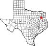 | |
| Towns | ||
| CDP | ||
| Other unincorporated communities |
| |
| Ghost towns | ||
| Footnotes | ‡This populated place also has portions in an adjacent county or counties | |
 | This article about a location in Smith County, Texas is a stub. You can help Wikipedia by expanding it. |