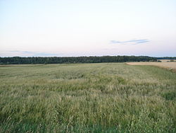
Smoligów
Smoligów | |
|---|---|
Village | |
 | |
| Coordinates: 50°38′N 23°57′E / 50.633°N 23.950°E | |
| Country | |
| Voivodeship | Lublin |
| County | Hrubieszów |
| Gmina | Mircze |
| Time zone | UTC+1 (CET) |
| • Summer (DST) | UTC+2 (CEST) |
| Vehicle registration | LHR |
Smoligów [smɔˈliɡuf] is a village in the administrative district of Gmina Mircze, within Hrubieszów County, Lublin Voivodeship, in eastern Poland, close to the border with Ukraine.[1] It lies approximately 4 kilometres (2 mi) south-east of Mircze, 21 km (13 mi) south of Hrubieszów, and 119 km (74 mi) south-east of the regional capital Lublin.
History[edit]
During the German occupation (World War II), on 27 March 1944, the village was pacified by the Germans and Ukrainian collaborators in reprisal for the villagers support for the Peasant Battalions Polish resistance organization. The number of victims is estimated between 66 and 232. There is a memorial in the village.
References[edit]


