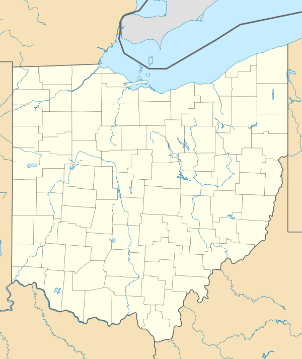
Module talk:Location map/data/USA Ohio

Page contents not supported in other languages.
From Wikipedia, the free encyclopedia
WikiProject iconMaps Template‑class
WikiProject iconThis module is within the scope of WikiProject Maps, a collaborative effort to improve the coverage of Maps and Cartography on Wikipedia. If you would like to participate, please visit the project page, where you can join the discussion and see a list of open tasks.
TemplateThis module does not require a rating on Wikipedia's content assessment scale.
WikiProject iconUnited States: Ohio Template‑class
WikiProject iconThis module is within the scope of WikiProject United States, a collaborative effort to improve the coverage of topics relating to the United States of America on Wikipedia. If you would like to participate, please visit the project page, where you can join the ongoing discussions.
TemplateThis module does not require a rating on Wikipedia's content assessment scale.
Taskforce icon
This module is supported by WikiProject Ohio.

Please update Template USA Ohio so that E,N,S,W borders align.[edit]

2008-06-30, Template USA Ohio lat_deg=38.25,42.2 lon_deg=80.06,85.28 corners:

Location map/data/USA Ohio is located in Ohio
Location map/data/USA Ohio
Template USA Ohio 2008-06-30 corners


These borders (from Google Earth/Maps) should line-up with the template, but on 2008-06-30, do not:

Location map/data/USA Ohio is located in Ohio
Oh-PA
Oh-PA
Mi-Oh
Mi-Oh
In-Mi-Oh
In-Mi-Oh
Oh-PA-WV
Oh-PA-WV
In-KY-Oh
In-KY-Oh
Ohio boundaries
I tweaked it some. OK now?--Appraiser (talk) 11:52, 30 June 2008 (UTC)[reply]
Your 2006-06-30 tweak works for my purposes (Location map+, map~ dots in NAD 83 coords).
With the thickness of the .PNG border lines, difficult to say exactly where a "border" is,
so map~ dots anything between 1/2-way overlapping and "dead center" are sufficient. :)
I was/am posting a longer comment on your Talk page (I got interrupted with something else),
Briefly, when Location map USA * templates are created or updated,
can such a corners/extremes check/verification map be posted on the Talk page (similar to my Alaska and Ohio examples)?

LeheckaG (talk) 14:12, 30 June 2008 (UTC)[reply]

I forgot to say Thank You, the 6/30 corners/edges update is appreciated. LeheckaG (talk) 14:54, 30 June 2008 (UTC)[reply]

Template-protected edit request on 3 February 2021[edit]

Topo map: image1 = 'USA Ohio relief location map.svg' SANtosito (talk) 03:54, 3 February 2021 (UTC)[reply]

 DoneJonesey95 (talk) 21:37, 6 February 2021 (UTC)[reply]