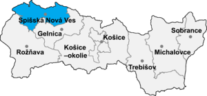
Kaľava

Kaľava (Hungarian: Szepeskárolyfalva, until 1899 Kalyava) is a village and municipality in the Spišská Nová Ves District in the Košice Region of central-eastern Slovakia. The village is situated on the southern side of the mountains Branisko.
History[edit]
In historical records the village was first mentioned in 1300.
Geography[edit]
The village lies at an altitude of 560 metres and covers an area of 4.45 km². It has a population of about 427 inhabitants.
Genealogical resources[edit]
The records for genealogical research are available at the state archive "Statny Archiv in Levoca, Slovakia"
- Roman Catholic church records (births/marriages/deaths): 1722-1918 (parish B)
See also[edit]
External links[edit]
48°56′N 20°52′E / 48.933°N 20.867°E
