
File:Map of the Far East of the USSR, Northern China (Manchuria) and Mongolia.tif

Original file (1,404 × 1,024 pixels, file size: 4.11 MB, MIME type: image/tiff)
| This is a file from the Wikimedia Commons. Information from its description page there is shown below. Commons is a freely licensed media file repository. You can help. |
Summary
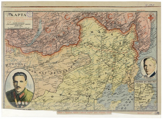
| Description | Map of the Far East of the USSR, Northern China (Manchuria) and Mongolia, 39 x 53 cm, 1:6 000 000 |
| Date | |
| Source |
http://www.wdl.org/zh/item/123/?ql=zho&a=-8000&b=2010&c=CN&r=EastAsia&view_type=gallery |
| Author | “Transreklama”NKPS, |
| Other versions |

Licensing
|
This work is in the public domain in its country of origin and other countries and areas where the copyright term is the author's life plus 70 years or fewer.
| |
| This file has been identified as being free of known restrictions under copyright law, including all related and neighboring rights. | |
File history
Click on a date/time to view the file as it appeared at that time.
| Date/Time | Thumbnail | Dimensions | User | Comment | |
|---|---|---|---|---|---|
| current | 16:57, 15 February 2011 |  | 1,404 × 1,024 (4.11 MB) | Shizhao | == {{int:filedesc}} == == {{int:filedesc}} == == {{int:filedesc}} == == {{int:filedesc}} == == {{int:filedesc}} == {{Information |Description=Map of the Far East of the USSR, Northern China (Manchuria) and Mongolia, 39 x 53 cm, 1:6 000 000 |Source=http:// |
File usage
Global file usage
The following other wikis use this file:
- Usage on ba.wikipedia.org
- Usage on cs.wikipedia.org
- Usage on hu.wikipedia.org
- Usage on ko.wikipedia.org
- Usage on mn.wikipedia.org
- Usage on nl.wikipedia.org
- Usage on ro.wikipedia.org
- Usage on ru.wikipedia.org
- Usage on th.wikipedia.org
- Usage on uk.wikipedia.org
- Usage on uz.wikipedia.org
- Usage on zh.wikipedia.org