
File:Canim Lake Bathymetric Map.pdf

Size of this JPG preview of this PDF file: 800 × 506 pixels. Other resolutions: 320 × 202 pixels | 640 × 404 pixels | 1,024 × 647 pixels | 1,280 × 809 pixels | 2,560 × 1,618 pixels | 5,320 × 3,362 pixels.
Original file (5,320 × 3,362 pixels, file size: 204 KB, MIME type: application/pdf)
| This is a file from the Wikimedia Commons. Information from its description page there is shown below. Commons is a freely licensed media file repository. You can help. |
Summary
| Description |
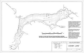
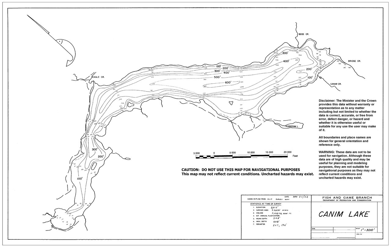
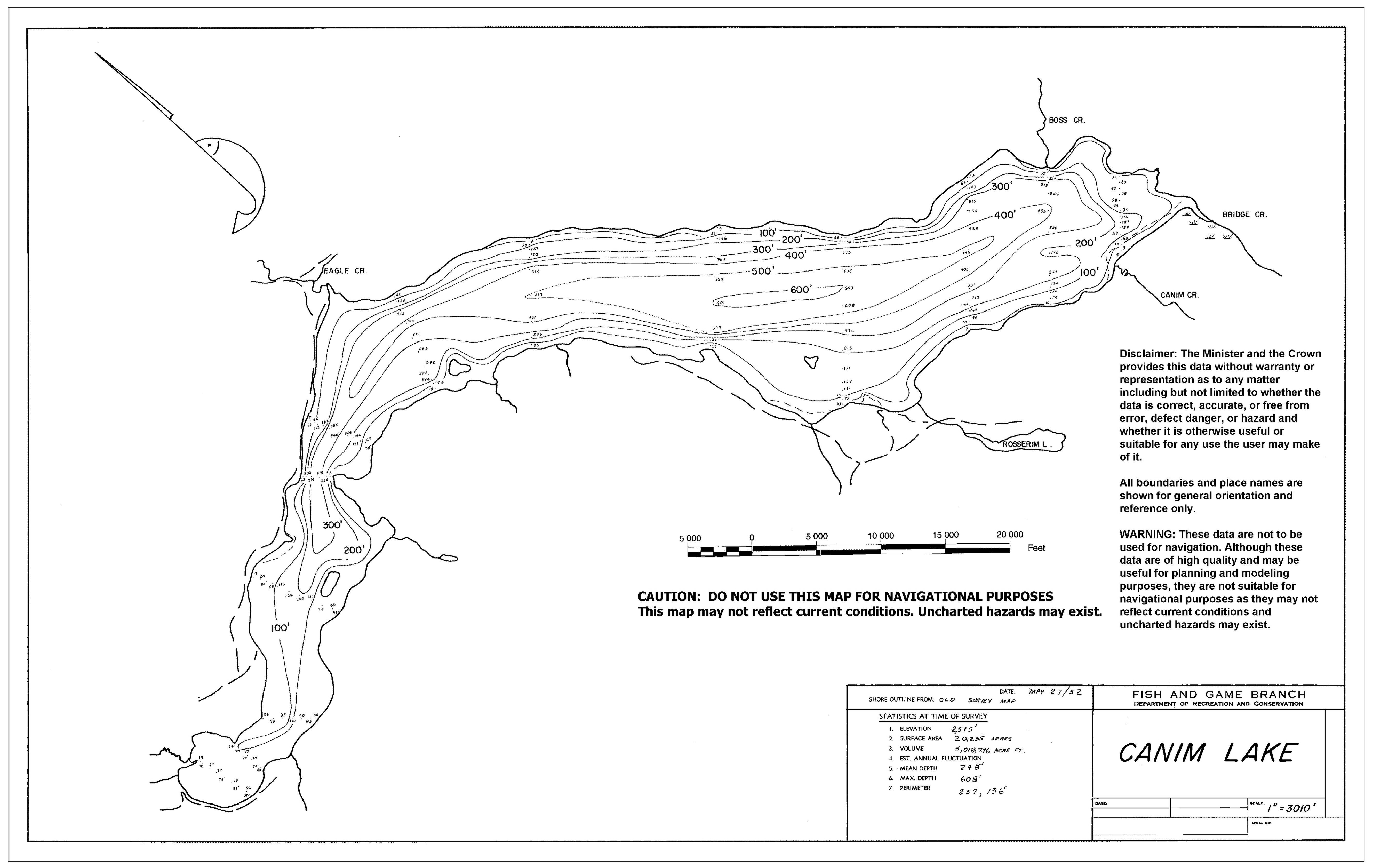
English: This Canim Lake Bathymetric Map was surveyed on May 27, 1952 by the British Columbia. Fish and Game Branch, currently known as the Fish and Wildlife Branch |
| Date | |
| Source | https://a100.gov.bc.ca/pub/fidq/downloadBathymetricMap.do?filename=00235301.pdf |
| Author | British Columbia Fish and Game Branch |
Licensing
 |
This file is licensed under the Open Government Licence – British Columbia 2.0. |
|
File history
Click on a date/time to view the file as it appeared at that time.
| Date/Time | Thumbnail | Dimensions | User | Comment | |
|---|---|---|---|---|---|
| current | 19:56, 12 April 2024 |  | 5,320 × 3,362 (204 KB) | Koltonsmith | Uploaded a work by British Columbia Fish and Game Branch from https://a100.gov.bc.ca/pub/fidq/downloadBathymetricMap.do?filename=00235301.pdf with UploadWizard |
File usage
The following pages on the English Wikipedia use this file (pages on other projects are not listed):