
Beclean, Brașov
Beclean | |
|---|---|
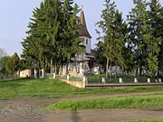
 The Saint Nicholas Church in Calbor | |
 Location within the county | |
 Beclean Location in Romania | |
| Coordinates: 45°50′00″N 24°56′00″E / 45.8333°N 24.9333°E | |
| Country | Romania |
| County | Brașov |
| Government | |
| • Mayor (2020–2024) | Vasile-Claudiu Motrescu[1] (PNL) |
| Area | 67.09 km2 (25.90 sq mi) |
| Elevation | 429 m (1,407 ft) |
| Population (2021-12-01)[2] | 2,002 |
| • Density | 30/km2 (77/sq mi) |
| Time zone | EET/EEST (UTC+2/+3) |
| Postal code | 507010 |
| Area code | (+40) 02 68 |
| Vehicle reg. | BV |
| Website | comunabeclean |
Beclean (German: Badlinen; Hungarian: Betlen) is a commune in Brașov County, Transylvania, Romania. It is composed of five villages: Beclean, Boholț (Buchholz; Boholc), Calbor (Kaltbrunnen; Kálbor), Hurez (Huréz), and Luța (Luca).
Geography[edit]
Beclean is situated in the western part of the county, in the historic Țara Făgărașului region. Located 3 km (1.9 mi) west of Făgăraș, it is crossed by the national road DN1 (part of European route E68); the county seat, Brașov, is 55 km (34 mi) to the east.
The commune lies on the left bank of the Olt River. The river Săvăstreni discharges into the Olt at Beclean.
References[edit]
- ^ "Results of the 2020 local elections". Central Electoral Bureau. Retrieved 9 June 2021.
- ^ "Populaţia rezidentă după grupa de vârstă, pe județe și municipii, orașe, comune, la 1 decembrie 2021" (XLS). National Institute of Statistics.
-
 Romanian Orthodox church in Beclean
 -
 Church of St. John the Baptist in Boholț
 -
 Church and monument in Hurez

.jpg)
.jpg)

This Brașov County location article is a stub. You can help Wikipedia by expanding it. |