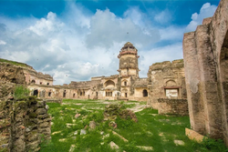
Ater Fort
| Ater Fort | |
|---|---|
 | |
| Location | Bhind district, Madhya Pradesh, India |
| Coordinates | 26°44′53″N 78°38′13″E / 26.748°N 78.637°E |
| Built | 1664-1668 |
| Architectural style(s) | Bhadawari and Mughal influence |
Location in Madhya Pradesh | |
Ater Fort is a fort located 35 km (22 mi) west of Bhind in Bhind district, Madhya Pradesh, India. It was built by Bhadauria kings Badan Singh, Maha Singh and Bakhat Singh between 1664 and 1668.[1][2]
Architecture[edit]
Khooni Darwaza, Badan Singh Ka Mahal, Hathiapor, Raja Ka Bangla, Rani Ka Bangla and Barah Khamba Mahal are some of the structures present in the fort.[1]


