
Široká Niva
Široká Niva | |
|---|---|
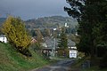
 General view | |
 Flag  Coat of arms | |
 Široká Niva Location in the Czech Republic | |
| Coordinates: 50°4′3″N 17°29′7″E / 50.06750°N 17.48528°E | |
| Country | |
| Region | Moravian-Silesian |
| District | Bruntál |
| First mentioned | 1420 |
| Area | |
| • Total | 37.29 km2 (14.40 sq mi) |
| Elevation | 368 m (1,207 ft) |
| Population (2023-01-01)[1] | |
| • Total | 556 |
| • Density | 15/km2 (39/sq mi) |
| Time zone | UTC+1 (CET) |
| • Summer (DST) | UTC+2 (CEST) |
| Postal code | 793 16 |
| Website | www |
Široká Niva (until 1952 Bretnov; German: Breitenau) is a municipality and village in Bruntál District in the Moravian-Silesian Region of the Czech Republic. It has about 600 inhabitants.
Administrative parts[edit]
The villages of Pocheň and Skrbovice are administrative parts of Široká Niva.
Geography[edit]
Široká Niva is located about 8 km (5 mi) north of Bruntál and 54 km (34 mi) north of Olomouc. It lies in the Nízký Jeseník range. The highest point is the hill Zlatý kopec at 693 m (2,274 ft) above sea level. The Opava River flows through the municipality.
History[edit]
The first written mention of Markvartice is from 1278 and the first written mention of Bretnov is from 1420. Pocheň was established in 1668. Skrbovice was founded by the Teutonic Order in 1678. In 1949, the municipalities of Markvartice, Bretnov and Skrbovice (including the hamlet of Pocheň) were merged. The new municipality was renamed to its current name Široká Niva in 1952. Today Markvartice is only a local name of a small part of Široká Niva.[2]
Demographics[edit]
|
|
| ||||||||||||||||||||||||||||||||||||||||||||||||||||||
| Source: Censuses[3][4] | ||||||||||||||||||||||||||||||||||||||||||||||||||||||||
Transport[edit]
Široká Niva is located on the railway line Vrbno pod Pradědem–Milotice nad Opavou.
Sights[edit]

The main landmark of Široká Niva is the Church of Saint Martin. It was built in the Baroque style in 1718–1721.[5]
Notable people[edit]
- Anton Zimmermann (1741–1781), Slovak composer
- Rudolf Koppitz (1884–1936), Austrian photographer
References[edit]
- ^ "Population of Municipalities – 1 January 2023". Czech Statistical Office. 2023-05-23.
- ^ "Historie obce" (in Czech). Obec Široká Niva. Retrieved 2022-03-16.
- ^ "Historický lexikon obcí České republiky 1869–2011 – Okres Krnov" (in Czech). Czech Statistical Office. 2015-12-21. pp. 11–12.
- ^ "Population Census 2021: Population by sex". Public Database. Czech Statistical Office. 2021-03-27.
- ^ "Obec Široká Niva" (in Czech). Sdružení obci Vrbenska. Retrieved 2023-10-30.
Gallery[edit]
-
 View from the south
 -
 Main street
 -
 A stream in Široká Niva


External links[edit]
| Authority control databases: National |
|---|