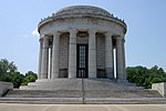
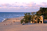
Portal:Indiana
The Indiana Portal
Various indigenous peoples inhabited what would become Indiana for thousands of years, some of whom the U.S. government expelled between 1800 and 1836. Indiana received its name because the state was largely possessed by native tribes even after it was granted statehood. Since then, settlement patterns in Indiana have reflected regional cultural segmentation present in the Eastern United States; the state's northernmost tier was settled primarily by people from New England and New York, Central Indiana by migrants from the Mid-Atlantic states and adjacent Ohio, and Southern Indiana by settlers from the Upland South, particularly Kentucky and Tennessee.
Indiana has a diverse economy with a gross state product of $352.62 billion in 2021. It has several metropolitan areas with populations greater than 100,000 and a number of smaller cities and towns. Indiana is home to professional sports teams, including the NFL's Indianapolis Colts and the NBA's Indiana Pacers. The state also hosts several notable competitive events, such as the Indianapolis 500, held at Indianapolis Motor Speedway. (Full article...)
Selected article -
The Wabash River /ˈwɔːbæʃ/ (French: Ouabache) is a 503-mile-long (810 km) river that drains most of the state of Indiana, and a significant part of Illinois, in the United States. It flows from the headwaters in Ohio, near the Indiana border, then southwest across northern Indiana turning south near the Illinois border, where the southern portion forms the Indiana-Illinois border before flowing into the Ohio River.
It is the largest northern tributary of the Ohio River and third largest overall, behind the Cumberland and Tennessee rivers. From the dam near Huntington, Indiana, to its terminus at the Ohio River, the Wabash flows freely for 411 miles (661 km) The Tippecanoe River, White River, Embarras River and Little Wabash River are major tributaries. The river's name comes from a Miami word meaning "water over white stones", as its bottom is white limestone, now obscured by mud. (Full article...)Selected image -
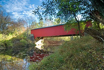 |
Did you know -
- ... that the first studio of Indiana high school radio station WETL was a cedar closet that had once stored furs?
- ... that the 2020 case Henderson v. Box held that the state of Indiana must list same-sex parents on their child's birth certificate?
- ... that an "army" of women were congratulated by Pat Nixon for their fundraising efforts to bring public TV to Indianapolis?
- ... that Gleaners Food Bank has served more than 700 million pounds (320 million kg) of food in Indiana?
- ... that Ganggang, an Indianapolis-based cultural development firm for Black artists, created a fine art fair called "Butter" that also included a dance party called "Melt"?
- ... that the Indianapolis African-American community raised $100,000 in just ten days in 1911 to establish the Senate Avenue YMCA?
Related portals
Selected geographic article -
Interstate 469 (I-469) is an Interstate Highway in northeastern Indiana. It is an auxiliary route of parent I-69 that also carries portions of US Highway 24 (US 24), US 30, and US 33 around the urban parts of Fort Wayne. It is 30.83 miles (49.62 km) in length. The Interstate was originally conceived as a bypass for US 24 around the south and east ends of Fort Wayne. Due to heavy traffic on US 30 through the city, support was gained to connect the bypass to I-69 on the city's north end. I-469 was given the name Ronald Reagan Expressway in 2005.
I-469 was the most expensive civic project in the history of Allen County, costing over $207 million (equivalent to $378 million in 2023). As a bypass route, I-469 has been ineffective at helping with north–south traffic along I-69. However, the route has served effectively as an east–west bypass around the city, removing heavy truck traffic from passing through Fort Wayne. (Full article...)Selected biography -
Carole Lombard (born Jane Alice Peters; October 6, 1908 – January 16, 1942) was an American actress. In 1999, the American Film Institute ranked Lombard 23rd on its list of the greatest female stars of Classic Hollywood Cinema.
Born into a wealthy family, Lombard was raised by her single mother. She made her screen debut in A Perfect Crime (1921) at the age of 12 and the experience spurred her and her mother to seek further film work, eventually resulting in a movie career. (Full article...)Selected quote
General images
Topics
- Economy: AM General - ATA Airlines - Casinos - Cummins - Delta - ITT - JayC - Lilly - Limestone - Manufacturing - NiSource - Shoe Carnival - Simon Property Group - Soybeans - Studebaker - Vectren - WellPoint
- Geography: Caves - Lakes - Rivers - State forests - Watersheds
Categories
Attractions
 |
Recognized content
| This is a list of recognized content, updated weekly by JL-Bot (talk · contribs) (typically on Saturdays). There is no need to edit the list yourself. If an article is missing from the list, make sure it is tagged (e.g. {{WikiProject Indiana}}) or categorized correctly and wait for the next update. See WP:RECOG for configuration options. |
Good articles
- 1963 Indiana State Fairgrounds Coliseum gas explosion
- 2006 Brickyard 400
- 2011 South Bend mayoral election
- 2015 South Bend mayoral election
- 2019 South Bend mayoral election
- 2021 NCAA Division I men's basketball championship game
- Max Bielfeldt
- The Fault in Our Stars (film)
- Hurley Goodall
- Proposed South Shore Line station in South Bend
- WCAE
Featured pictures
-
Kenje Ogata 1943
-
Kurt Vonnegut by Bernard Gotfryd (1965)
-
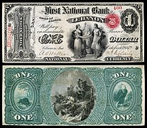
US-NBN-IL-Lebanon-2057-Orig-1-400-C
WikiProjects
State facts
Indiana | |
|---|---|
| Country | United States |
| Admitted to the Union | December 11, 1816 (19th) |
| Capital | Indianapolis |
| Largest city | Indianapolis |
| Largest metro and urban areas | Indianapolis-Carmel MSA |
| Government | |
| • Governor | Eric Holcomb (R) (2017) |
| • Lieutenant Governor | Suzanne Crouch (R) (2017) |
| Legislature | Indiana General Assembly |
| • Upper house | Senate |
| • Lower house | House of Representatives |
| U.S. senators | Todd Young (R) Mike Braun (R) |
| Population | |
| • Total | 6,080,485 |
| • Density | 169.5/sq mi (65.46/km2) |
| Language | |
| • Official language | English |
| Latitude | 37° 46′ N to 41° 46′ N |
| Longitude | 84° 47′ W to 88° 6′ W |
Things you can do
 |
Here are some tasks awaiting attention:
|
Associated Wikimedia
The following Wikimedia Foundation sister projects provide more on this subject:
-
Commons
Free media repository -
Wikibooks
Free textbooks and manuals -
Wikidata
Free knowledge base -
Wikinews
Free-content news -
Wikiquote
Collection of quotations -
Wikisource
Free-content library -
Wikiversity
Free learning tools -
Wikivoyage
Free travel guide -
Wiktionary
Dictionary and thesaurus
- ^ a b "Elevations and Distances in the United States". U.S Geological Survey. 29 April 2005. Retrieved 2006-11-06.


