
File:VietnameseProvincesMapTiengViet.png
Size of this preview: 360 × 600 pixels. Other resolutions: 144 × 240 pixels | 428 × 713 pixels.
Original file (428 × 713 pixels, file size: 45 KB, MIME type: image/png)
| This is a file from the Wikimedia Commons. Information from its description page there is shown below. Commons is a freely licensed media file repository. You can help. |
Summary
| Description |
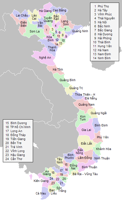
English: Labeled map of Vietnamese provinces |
| Source | Own work |
| Author | Vardion |
Licensing

|
Permission is granted to copy, distribute and/or modify this document under the terms of the GNU Free Documentation License, Version 1.2 or any later version published by the Free Software Foundation; with no Invariant Sections, no Front-Cover Texts, and no Back-Cover Texts. A copy of the license is included in the section entitled GNU Free Documentation License. |
| This file is licensed under the Creative Commons Attribution-Share Alike 3.0 Unported license. | ||
| ||
| This licensing tag was added to this file as part of the GFDL licensing update. |
File history
Click on a date/time to view the file as it appeared at that time.
| Date/Time | Thumbnail | Dimensions | User | Comment | |
|---|---|---|---|---|---|
| current | 07:40, 30 August 2018 | | 428 × 713 (45 KB) | 4nn1l2 | Reverted to version as of 23:28, 20 January 2006 (UTC) COM:OW |
| 02:48, 30 August 2018 |  | 1,621 × 2,000 (6.86 MB) | H.V.T Pro-4 | Merge "Hà Tây" into "Hà Nội" | |
| 23:28, 20 January 2006 |  | 428 × 713 (45 KB) | Vardion | more corrections | |
| 23:15, 20 January 2006 |  | 428 × 713 (45 KB) | Vardion | hopefully including both corrections on the same map... | |
| 23:11, 20 January 2006 |  | 428 × 713 (45 KB) | Mxn | Reverted to earlier revision | |
| 23:10, 20 January 2006 |  | 428 × 713 (45 KB) | Mxn | Reverted to earlier revision | |
| 22:52, 20 January 2006 |  | 428 × 713 (45 KB) | Vardion | spelling | |
| 21:59, 20 January 2006 |  | 428 × 713 (45 KB) | Vardion | correcting boundary between Dien Bien and Lai Chau provinces | |
| 21:52, 15 June 2005 |  | 428 × 713 (45 KB) | Vardion | Labeled map of Vietnamese provinces. Made for Wikipedia by uploader. {{GDFL}} |
File usage
No pages on the English Wikipedia use this file (pages on other projects are not listed).
Global file usage
The following other wikis use this file:
- Usage on an.wikipedia.org
- Usage on bg.wikipedia.org
- Usage on fr.wikipedia.org
- Usage on he.wikipedia.org
- Usage on hu.wikipedia.org
- Usage on id.wikipedia.org
- Usage on tg.wikipedia.org
- Usage on tl.wikipedia.org
- Usage on tr.wikipedia.org
- Usage on vi.wikipedia.org