
File:Tolosa, Euskal Herria.png

Size of this preview: 739 × 600 pixels. Other resolutions: 296 × 240 pixels | 592 × 480 pixels | 912 × 740 pixels.
Original file (912 × 740 pixels, file size: 400 KB, MIME type: image/png)
| This is a file from the Wikimedia Commons. Information from its description page there is shown below. Commons is a freely licensed media file repository. You can help. |
Summary
| Description |
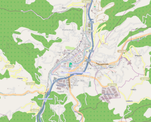
Euskara: Tolosa udalerriko kokapen mapa. Gipuzkoa, Euskal Herria - Location map of Tolosa. Gipuzkoa, Basque Country. |
| Source | http://www.openstreetmap.org/?mlat=43.26774&mlon=-2.02169&zoom=12 |
| Author | Open Street Map |
| Permission (Reusing this file) |
It´s a Free Wiki World Map |
Licensing
This file is licensed under the Creative Commons Attribution-Share Alike 3.0 Unported license.
- You are free:
- to share – to copy, distribute and transmit the work
- to remix – to adapt the work
- Under the following conditions:
- attribution – You must give appropriate credit, provide a link to the license, and indicate if changes were made. You may do so in any reasonable manner, but not in any way that suggests the licensor endorses you or your use.
- share alike – If you remix, transform, or build upon the material, you must distribute your contributions under the same or compatible license as the original.
File history
Click on a date/time to view the file as it appeared at that time.
| Date/Time | Thumbnail | Dimensions | User | Comment | |
|---|---|---|---|---|---|
| current | 20:43, 25 January 2011 | | 912 × 740 (400 KB) | Euskaldunaa | {{Information |Description ={{eu|1=Tolosa udalerriko kokapen mapa. Gipuzkoa, Euskal Herria - Location map of Tolosa. Gipuzkoa, Basque Country.}} |Source =http://www.openstreetmap.org/?mlat=43.26774&mlon=-2.02169&zoom=12 |Author =Open St |
File usage
The following pages on the English Wikipedia use this file (pages on other projects are not listed):
Global file usage
The following other wikis use this file:
- Usage on eu.wikipedia.org
- Usage on ru.wikipedia.org