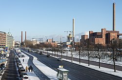
File:Sörnäisten rantatie in Helsinki, Finland, 2018 January.jpg

Page contents not supported in other languages.
This is a file from the Wikimedia Commons
From Wikipedia, the free encyclopedia

Original file(5,364 × 3,508 pixels, file size: 3.44 MB, MIME type: image/jpeg)

Summary

Sörnäisten rantatie  wikidata:Q18662197 reasonator:Q18662197  Add properties to Wikidata item based on this file
Photographer
Matti Similä
image of artwork listed in title parameter on this page
Title
Sörnäisten rantatie in Helsinki, Finland, 2018 January
Part of European route E75 in Finland Edit this at Wikidata
Object type street Edit this at Wikidata
Description
English: Sörnäisten rantatie street in Sörnäinen, Helsinki. Hanasaari Power Plant is clearly visible on the right. Majakka high-rise is under construction in the background.
Suomi: Sörnäisten rantatie. Kuvassa oikealla Hanasaaren voimalaitoksen B-voimala, kivihiilivoimala. Voimala-alueen takana Kalasatama rakennustyömaineen sekä Suvilahden entinen sähkön- ja kaasuntuotannon energiantuotantolaitos kaasukelloineen. Kuva otettu Sörnäisten rantatien ylittävältä Kaikukadun kevyen liikenteen sillalta.
Depicted place Sörnäisten rantatie in Helsinki, Finland
Date 31 January 2018
institution QS:P195,Q2031357
Accession number
G54444
Source Finna: Sörnäisten rantatie
Permission
(Reusing this file)
CC BY 4.0
Camera location60° 10′ 55.99″ N, 24° 57′ 40.4″ E Kartographer map based on OpenStreetMap.View this and other nearby images on: OpenStreetMapinfo

Licensing

w:en:Creative Commons
attribution share alike
This file is licensed under the Creative Commons Attribution-Share Alike 4.0 International license.
You are free:
  • to share – to copy, distribute and transmit the work
  • to remix – to adapt the work
Under the following conditions:
  • attribution – You must give appropriate credit, provide a link to the license, and indicate if changes were made. You may do so in any reasonable manner, but not in any way that suggests the licensor endorses you or your use.
  • share alike – If you remix, transform, or build upon the material, you must distribute your contributions under the same or compatible license as the original.

Captions

Add a one-line explanation of what this file represents

Items portrayed in this file

depicts

60°10'55.988"N, 24°57'40.403"E

31 January 2018

image/jpeg

File history

Click on a date/time to view the file as it appeared at that time.

Date/TimeThumbnailDimensionsUserComment
current21:17, 23 June 2021Thumbnail for version as of 21:17, 23 June 20215,364 × 3,508 (3.44 MB)CoenUploaded a work by Matti Similä from https://finna.fi/Record/hkm.HKMS000005:km0000q2wl with UploadWizard
The following pages on the English Wikipedia use this file (pages on other projects are not listed):

Global file usage

The following other wikis use this file:

Metadata