
File:Bergen Borought Map.png
Original file (1,240 × 1,754 pixels, file size: 90 KB, MIME type: image/png)
| This is a file from the Wikimedia Commons. Information from its description page there is shown below. Commons is a freely licensed media file repository. You can help. |
Summary
| Description |
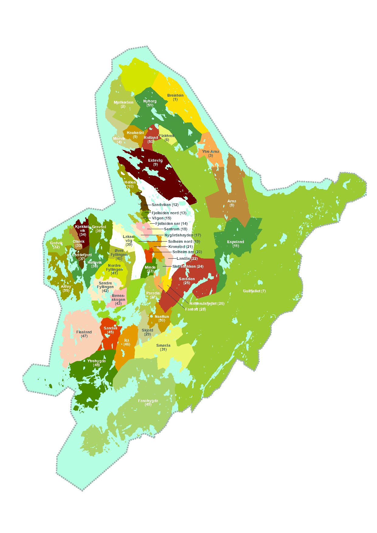
English: This map roughly shows the main non-administrative and informal boroughs (Norwegian: strøk ) of Bergen, Norway. Most of them are based on the limits of old agricultural and farm domains, and it is therefore possible to subdivide them and rearrange them.
Concerning the historic center of the city, here divided by the figures 12 to 18, the subdivisions are also possible. These divisions on the map are used by the Kommune to make some socio-economics studies. This map if therefore more informative in this context than historic or destined to be very accurate concerning deeper studies concerning domain limits etc. It represents the boroughs in which nowadays a person identifies themselves as inhabitant of this or that borough. Map legend:
Norsk bokmål: Dette kartet viser grovt sett de viktigste ikke-administrative og uformelle bydeler og strøk i Bergen. De fleste av dem er basert på grensene til gamle jordbruks- og gårdsdomener, og det er derfor mulig å dele dem inn og omorganisere dem.
Når det gjelder det historiske sentrum av byen, her delt med tallene 12 til 18, er underinndelingene også mulige. Disse inndelingene på kartet brukes av kommunen til å lage noen samfunnsøkonomiske studier. Dette kartet er derfor mer informativt i denne sammenheng enn historisk eller bestemt til å være svært nøyaktig når det gjelder dypere studier angående domenegrenser osv. Det representerer bydelene der en person i dag identifiserer seg som innbygger i denne eller den bydelen. Kartforklaring:
|
| Date | circa 2009 |
| Source | Made for this rapport: http://images.bt.no/btno/multimedia/archive/00540/LEVEKAARSRAPPORT_20_540698a.pdf[dead link] |
| Author | Nina Skauge for Bergen Kommune/Byråd for helse og omsorg, Bergen, Norway http://ninaskauge.no/ |

|
This map image could be re-created using vector graphics as an SVG file. This has several advantages; see Commons:Media for cleanup for more information. If an SVG form of this image is available, please upload it and afterwards replace this template with
{{vector version available|new image name}}.
It is recommended to name the SVG file “Bergen Borought Map.svg”—then the template Vector version available (or Vva) does not need the new image name parameter. |
Licensing
- You are free:
- to share – to copy, distribute and transmit the work
- to remix – to adapt the work
- Under the following conditions:
- attribution – You must give appropriate credit, provide a link to the license, and indicate if changes were made. You may do so in any reasonable manner, but not in any way that suggests the licensor endorses you or your use.
- share alike – If you remix, transform, or build upon the material, you must distribute your contributions under the same or compatible license as the original.
File history
Click on a date/time to view the file as it appeared at that time.
| Date/Time | Thumbnail | Dimensions | User | Comment | |
|---|---|---|---|---|---|
| current | 16:08, 22 January 2009 | | 1,240 × 1,754 (90 KB) | Skygge~commonswiki | {{Information |Description={{en|1=Made for this rapport: http://images.bt.no/btno/multimedia/archive/00540/LEVEKAARSRAPPORT_20_540698a.pdf This map roughly shows the main non-administrative and unformal boroughts (Norwegian: strøk) of Bergen. Most of th |
File usage
Global file usage
The following other wikis use this file: