
File:Vancouver Landsat.jpg

Size of this preview: 600 × 600 pixels. Other resolutions: 240 × 240 pixels | 480 × 480 pixels | 1,000 × 1,000 pixels.
Original file (1,000 × 1,000 pixels, file size: 231 KB, MIME type: image/jpeg)
| This is a file from the Wikimedia Commons. Information from its description page there is shown below. Commons is a freely licensed media file repository. You can help. |
| Description |
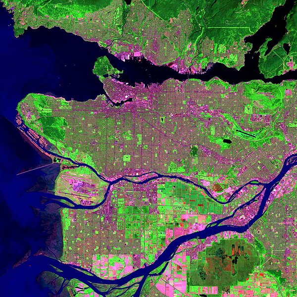
English: Landsat image of Vancouver, British Columbia.
This image is a work of the National Oceanic and Atmospheric Administration, taken or made during the course of an employee's official duties. As works of the U.S. federal government, all NOAA images are in the public domain. |
| Source | Own work |
| Author | User:Voyager |
| Other versions |
Derivative works of this file: Bodies of water in Vancouver.jpg - |
This image is in the public domain because it contains materials that originally came from the U.S. National Oceanic and Atmospheric Administration, taken or made as part of an employee's official duties.
|
File history
Click on a date/time to view the file as it appeared at that time.
| Date/Time | Thumbnail | Dimensions | User | Comment | |
|---|---|---|---|---|---|
| current | 13:16, 27 January 2007 | | 1,000 × 1,000 (231 KB) | Voyager | Landsat image of Vancouver, British Columbia. This image is a work of the National Oceanic and Atmospheric Administration, taken or made during the course of an employee's official duties. As works of the U.S. federal government, all NOAA images are in t |
File usage
More than 100 pages use this file. The following list shows the first 100 pages that use this file only. A full list is available.
- Alex Fraser Bridge
- Arthur Laing Bridge
- BC Place
- Burrard Bridge
- Burrard Inlet
- Burrard Peninsula
- Cambie Bridge
- Canada Place
- Capilano Suspension Bridge
- Chinatown, Vancouver
- Commercial Drive, Vancouver
- Cypress Mountain Ski Area
- Dominion Building
- English Bay, Vancouver
- Fraser River
- Gastown
- Golden Ears Bridge
- Granville Island
- Granville Street Bridge
- Hotel Vancouver
- Kitsilano Beach
- Knight Street Bridge
- Landsat program
- Lions Gate Bridge
- List of tallest buildings in Vancouver
- Marine Building
- Metropolis at Metrotown
- Mount Seymour
- Oak Street Bridge
- One Wall Centre
- Orpheum (Vancouver)
- Pacific Central Station
- Pacific Coliseum
- Pattullo Bridge
- Pitt River Bridge
- Port Mann Bridge
- Punjabi Market, Vancouver
- Queen Elizabeth Park, British Columbia
- Queensborough Bridge
- Rogers Arena
- Science World (Vancouver)
- Stanley Park
- Sun Tower
- Vancouver
- Vancouver Aquarium
- Vancouver Art Gallery
- Vancouver City Hall
- Vancouver Public Library
- Waterfront station (Vancouver)
- Talk:2005 Vancouver municipal election
- Talk:2010 Winter Olympics
- Talk:2010 Winter Paralympics
- Talk:9 O'Clock Gun
- Talk:Air BC
- Talk:Burnaby
- Talk:Burnaby-Edmonds
- Talk:Burns Bog
- Talk:CHAN-DT
- Talk:Cambie Street
- Talk:Canada Line
- Talk:Canadian Pacific Air Lines
- Talk:Capilano Suspension Bridge
- Talk:Collingwood School
- Talk:Commercial Drive, Vancouver
- Talk:Coquitlam
- Talk:Cypress Provincial Park
- Talk:Douglas Albert Munro
- Talk:Douglas Coupland
- Talk:Downtown Eastside
- Talk:Ernest Smith
- Talk:Gabrielle Miller
- Talk:Gordon Campbell
- Talk:Hayden Christensen
- Talk:Ironworkers Memorial Second Narrows Crossing
- Talk:Larry Campbell
- Talk:Laurence J. Peter
- Talk:Libby Davies
- Talk:List of Vancouver media
- Talk:List of tallest buildings in Vancouver
- Talk:Margaret Trudeau
- Talk:Mike Harcourt
- Talk:Museum of Anthropology at UBC
- Talk:New Westminster
- Talk:North Vancouver
- Talk:North Vancouver (district municipality)
- Talk:Oneworld
- Talk:Port Coquitlam-Burke Mountain
- Talk:Port Moody-Westwood
- Talk:Richmond, British Columbia
- Talk:Robert Pickton
- Talk:Science World (Vancouver)
- Talk:Simon Fraser Student Society
- Talk:Sir Winston Churchill Secondary School (Vancouver)
- Talk:Surrey, British Columbia
- Talk:TED (conference)
- Talk:TransLink (British Columbia)
- Talk:Trinity Western University
- Talk:Vancouver Downtown Historic Railway
- Talk:West Vancouver
- Talk:West Vancouver Secondary School
View more links to this file.
Global file usage
The following other wikis use this file:
- Usage on cs.wikipedia.org
- Usage on de.wikipedia.org
- Usage on es.wikipedia.org
- Usage on fa.wikipedia.org
- Usage on it.wikipedia.org
- Usage on nn.wikipedia.org
- Usage on no.wikipedia.org
- Usage on pt.wikipedia.org
- Usage on ru.wikipedia.org
- Usage on sk.wikipedia.org
- Usage on sr.wikipedia.org
- Usage on sv.wikipedia.org
- Usage on tr.wikipedia.org
- Usage on zh.wikipedia.org