
File:The Priory Church of St Mary, St Katharine and All Saints, Edington - geograph.org.uk - 1008817.jpg
No higher resolution available.
The_Priory_Church_of_St_Mary,_St_Katharine_and_All_Saints,_Edington_-_geograph.org.uk_-_1008817.jpg (640 × 480 pixels, file size: 88 KB, MIME type: image/jpeg)
| This is a file from the Wikimedia Commons. Information from its description page there is shown below. Commons is a freely licensed media file repository. You can help. |
Summary
| Description |
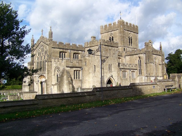
English: The Priory Church of St Mary, St Katharine and All Saints, Edington The parish of Edington straddles the steep northern escarpment of Salisbury Plain. Apart from some very minor indications of an earlier Norman church found during restoration, the church dates from around 1350 and was consecrated by the Bishop of Salisbury in 1361. The church is a fine example of the transition from the Decorated to the Perpendicular style. |
| Date | |
| Source | From geograph.org.uk |
| Author | Trish Steel |
| Camera location | | View this and other nearby images on: OpenStreetMap |
|---|
_heading:45.00&language=en)
| Object location | | View this and other nearby images on: OpenStreetMap |
|---|
_heading:45.00&language=en)
Licensing

|
This image was taken from the Geograph project collection. See this photograph's page on the Geograph website for the photographer's contact details. The copyright on this image is owned by Trish Steel and is licensed for reuse under the Creative Commons Attribution-ShareAlike 2.0 license.
|
This file is licensed under the Creative Commons Attribution-Share Alike 2.0 Generic license.
Attribution: Trish Steel
- You are free:
- to share – to copy, distribute and transmit the work
- to remix – to adapt the work
- Under the following conditions:
- attribution – You must give appropriate credit, provide a link to the license, and indicate if changes were made. You may do so in any reasonable manner, but not in any way that suggests the licensor endorses you or your use.
- share alike – If you remix, transform, or build upon the material, you must distribute your contributions under the same or compatible license as the original.
File history
Click on a date/time to view the file as it appeared at that time.
| Date/Time | Thumbnail | Dimensions | User | Comment | |
|---|---|---|---|---|---|
| current | 08:44, 23 February 2011 | | 640 × 480 (88 KB) | GeographBot | == {{int:filedesc}} == {{Information |description={{en|1=The Priory Church of St Mary, St Katharine and All Saints, Edington The parish of Edington straddles the steep northern escarpment of Salisbury Plain. Apart from some very minor indications of an e |
File usage
The following pages on the English Wikipedia use this file (pages on other projects are not listed):