
File:Stak Valley.jpg
No higher resolution available.
Stak_Valley.jpg (640 × 480 pixels, file size: 171 KB, MIME type: image/jpeg)
| This is a file from the Wikimedia Commons. Information from its description page there is shown below. Commons is a freely licensed media file repository. You can help. |
Summary
| Description |
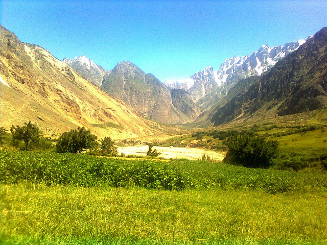
English: This picture is taken from the last village (Tookla) of Stak Valley towards the north. The peak at the northern end is the Samagi and Parabar Peak is just on its shoulders. The white blanketed part with the Samagi is the Goropha Glacier's basin. The valley leading to West is the Kutia Lungma and the Valley leading to East is the Ranga Lungma. |
| Date | |
| Source | Own work |
| Author | Arif Rizvi |
Licensing
I, the copyright holder of this work, hereby publish it under the following license:
This file is licensed under the Creative Commons Attribution-Share Alike 4.0 International license.
- You are free:
- to share – to copy, distribute and transmit the work
- to remix – to adapt the work
- Under the following conditions:
- attribution – You must give appropriate credit, provide a link to the license, and indicate if changes were made. You may do so in any reasonable manner, but not in any way that suggests the licensor endorses you or your use.
- share alike – If you remix, transform, or build upon the material, you must distribute your contributions under the same or compatible license as the original.
File history
Click on a date/time to view the file as it appeared at that time.
| Date/Time | Thumbnail | Dimensions | User | Comment | |
|---|---|---|---|---|---|
| current | 09:26, 4 November 2016 | | 640 × 480 (171 KB) | TMOR | Cross-wiki upload from en.wikipedia.org |
File usage
The following pages on the English Wikipedia use this file (pages on other projects are not listed):
Global file usage
The following other wikis use this file:
- Usage on fr.wikipedia.org
- Usage on www.wikidata.org