
File:Rothschild Boulevard - WLM 2013 - ovedc - 11.JPG

Size of this preview: 450 × 600 pixels. Other resolutions: 180 × 240 pixels | 360 × 480 pixels | 576 × 768 pixels | 768 × 1,024 pixels | 1,536 × 2,048 pixels | 2,736 × 3,648 pixels.
Original file (2,736 × 3,648 pixels, file size: 2.65 MB, MIME type: image/jpeg)
| This is a file from the Wikimedia Commons. Information from its description page there is shown below. Commons is a freely licensed media file repository. You can help. |
Summary
| Description |
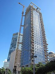
עברית: שדרות רוטשילד היו בין ארבעת הרחובות הראשונים של תל אביב (שנקראה אז "אחוזת בית"), שנחנכו לאחר רחוב הרצל (הרחוב הראשון בעיר), ובניצב אליו. הרחובות נסללו על גבי דיונות חול אשר יושרו ושוטחו, ולאורכם נבנו בתיה הראשונים של העיר. התוואי שהפך להיות השדרה היה ואדי קטן שאותו קשה היה ליישר באמצעים של אז, ואליו גם התנקזו מים רבים בחורף. בשל כך הוחלט למלאו בחול להשאירו כשטח פתוח שעליו לא ייבנו בתים אלא בצדיו, כרחוב עירוני רחב יותר. בט"ו בשבט ה'תר"ע (1910) החלו נטיעות בשטח פתוח זה, במטרה להפוך את הרחוב לשדרה הראשונה של העיר. חודשים אחדים לאחר מכן, בדצמבר 1910, החליט ועד אחוזת בית לקרוא לשדרה על שם הברון רוטשילד, ולמנות את מרדכי בן הלל הכהן ואת מאיר דיזנגוף להודיע על כך באופן רשמי לברון. אנשי אחוזת בית ראו בשדרה את תחילתה של שדרה מפוארת כדוגמת הבולווארים המפוארים של פריז.
|
||
| Date | |||
| Source | Own work | ||
| Author | Ovedc |
| Camera location | | View this and other nearby images on: OpenStreetMap |
|---|
Licensing
I, the copyright holder of this work, hereby publish it under the following license:
This file is licensed under the Creative Commons Attribution-Share Alike 3.0 Unported license.
- You are free:
- to share – to copy, distribute and transmit the work
- to remix – to adapt the work
- Under the following conditions:
- attribution – You must give appropriate credit, provide a link to the license, and indicate if changes were made. You may do so in any reasonable manner, but not in any way that suggests the licensor endorses you or your use.
- share alike – If you remix, transform, or build upon the material, you must distribute your contributions under the same or compatible license as the original.

|
This image was uploaded as part of Wiki Loves Monuments 2013.
|
 |
File history
Click on a date/time to view the file as it appeared at that time.
| Date/Time | Thumbnail | Dimensions | User | Comment | |
|---|---|---|---|---|---|
| current | 14:53, 5 October 2013 | | 2,736 × 3,648 (2.65 MB) | Ovedc | User created page with UploadWizard |
File usage
The following pages on the English Wikipedia use this file (pages on other projects are not listed):
Global file usage
The following other wikis use this file:
- Usage on ar.wikipedia.org
- Usage on as.wikipedia.org
- Usage on ga.wikipedia.org
- Usage on he.wikipedia.org
- Usage on hu.wikipedia.org
- Usage on pl.wikipedia.org
- Usage on pt.wikipedia.org
- Usage on ru.wikipedia.org
- Usage on uk.wikipedia.org
- Usage on www.wikidata.org