
File:Pad van Ad op OSM.png
Size of this preview: 651 × 600 pixels. Other resolutions: 260 × 240 pixels | 521 × 480 pixels | 834 × 768 pixels | 1,111 × 1,024 pixels | 1,286 × 1,185 pixels.
Original file (1,286 × 1,185 pixels, file size: 1.62 MB, MIME type: image/png)
| This is a file from the Wikimedia Commons. Information from its description page there is shown below. Commons is a freely licensed media file repository. You can help. |
Summary
| Description |
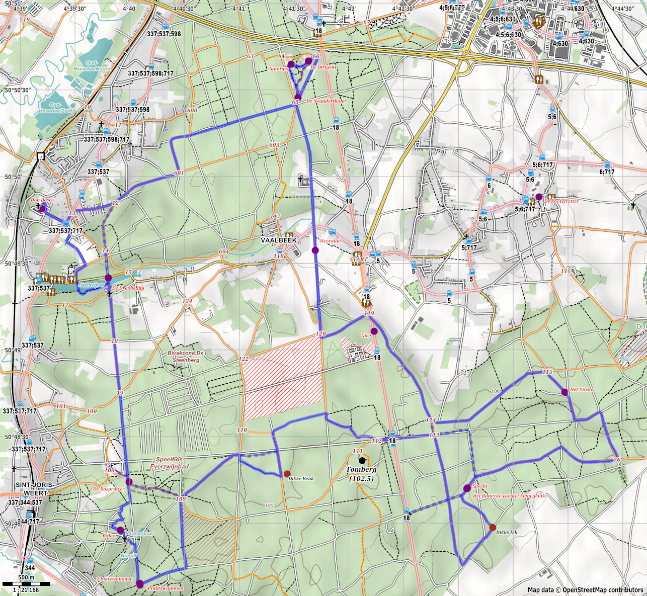
Nederlands: Rendering van 't Pad van Ad met Maperitive |
| Date | |
| Source | Own work |
| Author | Polyglot |
| Camera location | | View this and other nearby images on: OpenStreetMap |
|---|
Licensing
| This work contains information from OpenStreetMap, which is made available under the Open Database License (ODbL).
The ODbL does not require any particular license for maps produced from ODbL data. Prior to 1 August 2020, map tiles produced by the OpenStreetMap Foundation were licensed under the CC-BY-SA-2.0 license. Maps produced by other people may be subject to other licences. |
I, the copyright holder of this work, hereby publish it under the following license:
This file is licensed under the Creative Commons Attribution-Share Alike 3.0 Unported license.
- You are free:
- to share – to copy, distribute and transmit the work
- to remix – to adapt the work
- Under the following conditions:
- attribution – You must give appropriate credit, provide a link to the license, and indicate if changes were made. You may do so in any reasonable manner, but not in any way that suggests the licensor endorses you or your use.
- share alike – If you remix, transform, or build upon the material, you must distribute your contributions under the same or compatible license as the original.
File history
Click on a date/time to view the file as it appeared at that time.
| Date/Time | Thumbnail | Dimensions | User | Comment | |
|---|---|---|---|---|---|
| current | 08:03, 19 April 2014 | | 1,286 × 1,185 (1.62 MB) | Polyglot | removed a variation from the route |
| 22:31, 17 April 2014 |  | 861 × 793 (847 KB) | Polyglot | Improved the size of the labels | |
| 05:25, 17 April 2014 |  | 716 × 674 (670 KB) | Polyglot | Improved rendering, added bus lines and stops, added alternative shortcuts with dashed lines, added Don Bosco statue | |
| 00:21, 17 April 2014 |  | 900 × 847 (536 KB) | Polyglot | Improved rendering, added bus lines and stops, added alternative shortcuts with dashed lines | |
| 00:16, 23 March 2014 |  | 837 × 750 (779 KB) | Polyglot | and again | |
| 00:13, 23 March 2014 |  | 837 × 750 (779 KB) | Polyglot | new attempt | |
| 00:11, 23 March 2014 |  | 837 × 750 (779 KB) | Polyglot | Improved and added a work of art, which was inaugurated today. | |
| 18:45, 19 March 2014 |  | 820 × 766 (785 KB) | Polyglot | Removed unnamed trees changed positions of labels so Everzwijnbad shows up now reduced canvas a bit | |
| 18:02, 19 March 2014 |  | 741 × 683 (630 KB) | Polyglot | 't Pad van Ad along wood sculputures of Ad Wouters route to follow on foot or by bicycle through Heverleebos and Meerdaalwoud made the walking nodes more modest added Speelbos Everzwijnveld changed the way the names of the sculptures are shown, norma... | |
| 06:09, 19 March 2014 |  | 619 × 570 (468 KB) | Polyglot | User created page with UploadWizard |
File usage
The following pages on the English Wikipedia use this file (pages on other projects are not listed):
Global file usage
The following other wikis use this file:
- Usage on de.wikipedia.org
- Usage on nl.wikipedia.org
- Usage on nl.wikivoyage.org
- Usage on ru.wikivoyage.org