
File:Nuevo mapa de la Republica Argentina (1914).jpg
Size of this preview: 375 × 599 pixels. Other resolutions: 150 × 240 pixels | 300 × 480 pixels | 481 × 768 pixels | 641 × 1,024 pixels | 1,282 × 2,048 pixels | 4,719 × 7,535 pixels.
Original file (4,719 × 7,535 pixels, file size: 14.85 MB, MIME type: image/jpeg)
| This is a file from the Wikimedia Commons. Information from its description page there is shown below. Commons is a freely licensed media file repository. You can help. |
Summary
| Description |
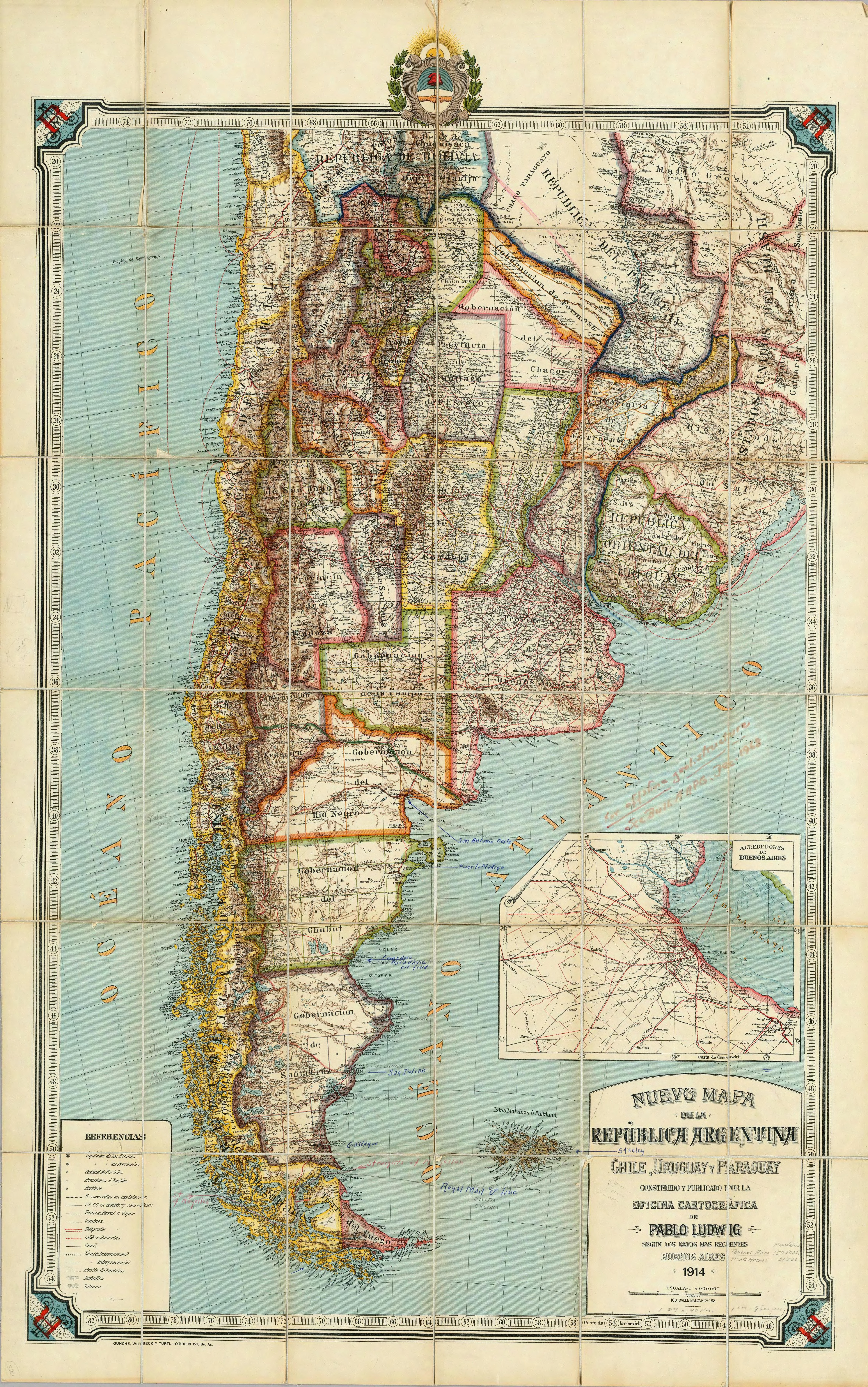
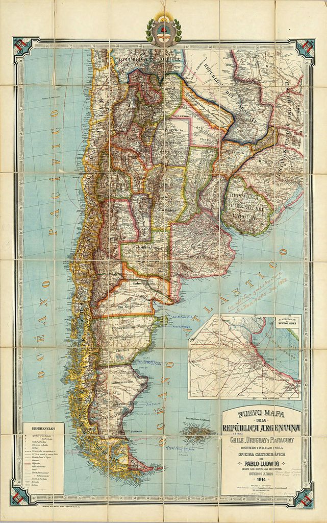
English: New map of the Republic of Argentina, Chile, Uruguay and Paraguay made and published by the Cartographic Office of Pablo Ludwig according to the most recent data. Buenos Aires, 1914, Gunche, Wiebeck and Turtl- O'Brien 121, Bs. As. (with Greater Buenos Aires inset) Español: Nuevo mapa de la Republica Argentina, Chile, Uruguay y Paraguay construido y publicado por la Oficina Cartografica de Pablo Ludwig segun los datos mas recientes. Buenos Aires,1914. Gunche, Wiebeck y Turtl-O'Brien 121, Bs. As. (con Alrededores de Buenos Aires) |
| Date | |
| Source | here |
| Author | Pablo Ludwig |
| Other versions |
|

.png)
.jpg)
Licensing
|
This work is in the public domain in its country of origin and other countries and areas where the copyright term is the author's life plus 70 years or fewer. This work is in the public domain in the United States because it was published (or registered with the U.S. Copyright Office) before January 1, 1929. | |
| This file has been identified as being free of known restrictions under copyright law, including all related and neighboring rights. | |
Original upload log
This image is a derivative work of the following images:
- File:Nuevo_mapa_de_la_Republica_Argentina_(1914).djvu licensed with PD-old
- 2008-09-15T23:15:14Z Createaccount 4719x7535 (8985530 Bytes) {{Information |Description={{es|1=Nuevo mapa de la Republica Argentina, Chile, Uruguay y Paraguay construido y publicado por la Oficina Cartografica de Pablo Ludwig segun los datos mas recientes. Buenos Aires,1914. Gunche, Wi
Uploaded with derivativeFX
File history
Click on a date/time to view the file as it appeared at that time.
| Date/Time | Thumbnail | Dimensions | User | Comment | |
|---|---|---|---|---|---|
| current | 21:13, 11 September 2010 | | 4,719 × 7,535 (14.85 MB) | Malus Catulus | {{Information |Description={{es|1=Nuevo mapa de la Republica Argentina, Chile, Uruguay y Paraguay construido y publicado por la Oficina Cartografica de Pablo Ludwig segun los datos mas recientes. Buenos Aires,1914. Gunche, Wiebeck y Turtl-O'Brien 121, Bs. |
File usage
The following pages on the English Wikipedia use this file (pages on other projects are not listed):
Global file usage
The following other wikis use this file:
- Usage on azb.wikipedia.org
- Usage on ca.wikipedia.org
- Usage on es.wikipedia.org
- Usage on hr.wiktionary.org
.jpg)