
File:Norwegian Air Shuttle routes domestic.svg

Size of this PNG preview of this SVG file: 501 × 526 pixels. Other resolutions: 229 × 240 pixels | 457 × 480 pixels | 731 × 768 pixels | 975 × 1,024 pixels | 1,951 × 2,048 pixels.
Original file (SVG file, nominally 501 × 526 pixels, file size: 104 KB)
| This is a file from the Wikimedia Commons. Information from its description page there is shown below. Commons is a freely licensed media file repository. You can help. |
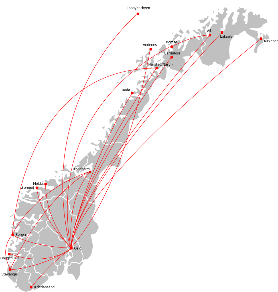
| Description | Map of the domestic route network of Norwegian Air Shuttle, per 2009. |
| Date | (UTC) |
| Source | |
| Author |
|
I, the copyright holder of this work, hereby publish it under the following license:
This file is licensed under the Creative Commons Attribution-Share Alike 3.0 Unported license.
- You are free:
- to share – to copy, distribute and transmit the work
- to remix – to adapt the work
- Under the following conditions:
- attribution – You must give appropriate credit, provide a link to the license, and indicate if changes were made. You may do so in any reasonable manner, but not in any way that suggests the licensor endorses you or your use.
- share alike – If you remix, transform, or build upon the material, you must distribute your contributions under the same or compatible license as the original.
Original upload log
This image is a derivative work of the following images:
- File:Airports_in_Norway_map.svg licensed with Cc-by-sa-3.0
- 2009-09-12T12:15:38Z Arsenikk 501x526 (174213 Bytes) {{Information |Description=Map of Norway with all current and former public and military airports. This excludes private airports without scheduled services. Note: Svalbard and Jan Mayen are not to scale, and not geographical
Uploaded with derivativeFX
File history
Click on a date/time to view the file as it appeared at that time.
| Date/Time | Thumbnail | Dimensions | User | Comment | |
|---|---|---|---|---|---|
| current | 11:46, 9 June 2017 | | 501 × 526 (104 KB) | Arsenikk | Update to routes as of summer schedule of 2017 |
| 22:46, 3 November 2011 |  | 501 × 526 (108 KB) | Arsenikk | Update with new routes | |
| 13:30, 20 February 2010 |  | 501 × 526 (104 KB) | Arsenikk | Plus Stavanger-Trondheim (new) and Oslo-Bodø (left out) | |
| 20:30, 12 September 2009 |  | 501 × 526 (101 KB) | Arsenikk | Added OSL-BGO | |
| 20:24, 12 September 2009 |  | 501 × 526 (103 KB) | Arsenikk | {{Information |Description=Map of the domestic route network of Norwegian Air Shuttle, per 2009. |Source=*File:Airports_in_Norway_map.svg |Date=2009-09-12 20:23 (UTC) |Author=*File:Airports_in_Norway_map.svg: *[[:File:Norway_counties_blank.svg |
File usage
The following pages on the English Wikipedia use this file (pages on other projects are not listed):
Global file usage
The following other wikis use this file:
- Usage on no.wikipedia.org