
File:Monashee Mountains2.jpg
Original file (1,155 × 1,192 pixels, file size: 780 KB, MIME type: image/jpeg)
| This is a file from the Wikimedia Commons. Information from its description page there is shown below. Commons is a freely licensed media file repository. You can help. |
Summary
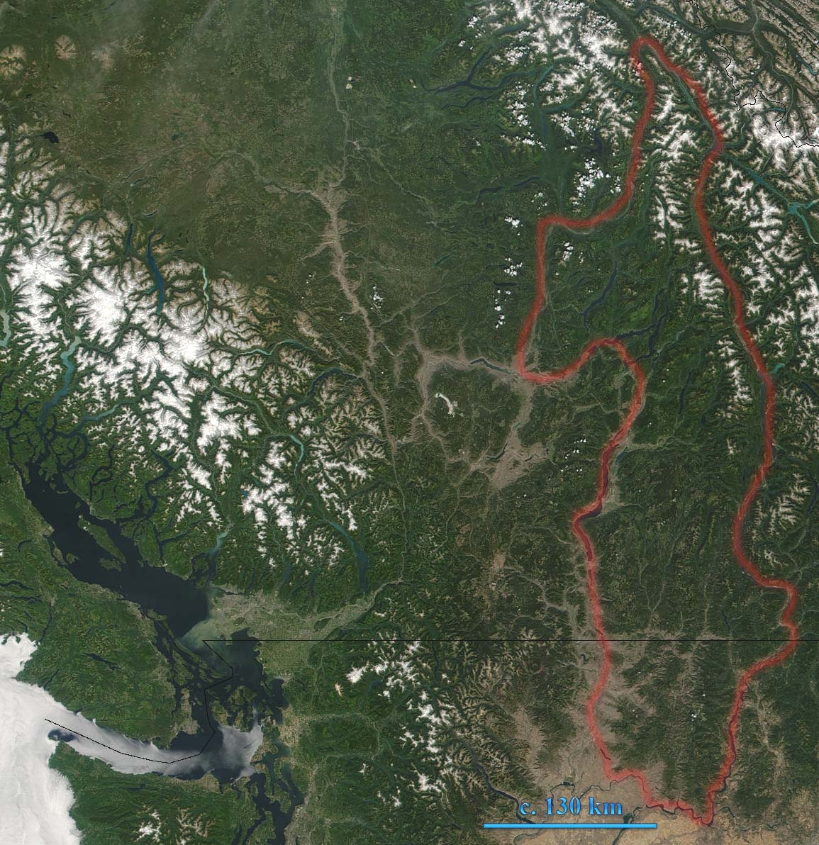
Monashee Mountains in British Columbia, Canada are indicated. The boundary shown includes the Okanagan Highland and the southeastern Shuswap Highland, which are sometimes reckoned to be part of the Interior Plateau. This true-color MODIS image shows southern British Columbia. In the left of the image lies Vancouver Island, which is separated from Washington by the Juan de Fuca Strait. British Columbia's glacier-capped Coast Mountain Range runs northwest-southeast inland from Vancouver Island.
Source: [1] archive copy at the Wayback Machine
Modified by User:Skookum1 from original Image:Monashee Mountains.jpg- image brightened for better visibility
Licensing
| This file is in the public domain in the United States because it was solely created by NASA. NASA copyright policy states that "NASA material is not protected by copyright unless noted". (See Template:PD-USGov, NASA copyright policy page or JPL Image Use Policy.) | ||
 |
Warnings:
|
File history
Click on a date/time to view the file as it appeared at that time.
| Date/Time | Thumbnail | Dimensions | User | Comment | |
|---|---|---|---|---|---|
| current | 22:26, 9 January 2007 | | 1,155 × 1,192 (780 KB) | Skookum1 | Monashee Mountains in British Columbia, Canada are indicated. This true-color MODIS image shows southern British Columbia. In the left of the image lies Vancouver Island, which is separated from Washington by the Juan de Fuca Strait. British Columbia's gl |
File usage
Global file usage
The following other wikis use this file:
- Usage on zh.wikipedia.org