
File:Mappa Ogaden.svg

Size of this PNG preview of this SVG file: 627 × 600 pixels. Other resolutions: 251 × 240 pixels | 502 × 480 pixels | 803 × 768 pixels | 1,071 × 1,024 pixels | 2,141 × 2,048 pixels | 1,150 × 1,100 pixels.
Original file (SVG file, nominally 1,150 × 1,100 pixels, file size: 736 KB)
| This is a file from the Wikimedia Commons. Information from its description page there is shown below. Commons is a freely licensed media file repository. You can help. |
| Description |
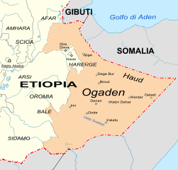
Italiano: Mappa dell'Etiopia (in italiano) con la regione dell'Ogaden (arancione) e quelle circostanti |
| Date | (UTC) |
| Source | |
| Author |
|
| This is a retouched picture, which means that it has been digitally altered from its original version. Modifications: Italiano. The original can be viewed here: Karte Ogaden Haud Somali.gif:
|
I, the copyright holder of this work, hereby publish it under the following license:
This file is licensed under the Creative Commons Attribution-Share Alike 2.5 Generic license.
- You are free:
- to share – to copy, distribute and transmit the work
- to remix – to adapt the work
- Under the following conditions:
- attribution – You must give appropriate credit, provide a link to the license, and indicate if changes were made. You may do so in any reasonable manner, but not in any way that suggests the licensor endorses you or your use.
- share alike – If you remix, transform, or build upon the material, you must distribute your contributions under the same or compatible license as the original.
Original upload log
This image is a derivative work of the following images:
- File:Karte_Ogaden_Haud_Somali.gif licensed with Cc-by-sa-2.5
- 2007-06-22T17:27:08Z Lencer 1000x855 (187819 Bytes)
- 2007-06-03T12:20:41Z Lencer 1000x852 (171877 Bytes)
- 2007-06-03T11:15:20Z Lencer 1000x852 (183014 Bytes)
- 2007-05-31T19:58:35Z Lencer 1000x852 (173084 Bytes)
- 2007-05-31T19:49:50Z Lencer 1000x852 (165946 Bytes)
- 2007-05-29T20:01:42Z Lencer 1000x852 (203857 Bytes)
- 2007-05-28T19:36:19Z Lencer 1000x859 (163030 Bytes) {{Information |Description= Karte Äthiopien mit Region Somali, Ogaden und Haud |Source="own work" |Date=Mai 2007 |Author=[[User:Lencer|Lencer]] |other_versions= }} {{Kartenwerkstatt}} == Licensing == {{GFDL-GMT}}
Uploaded with derivativeFX
File history
Click on a date/time to view the file as it appeared at that time.
| Date/Time | Thumbnail | Dimensions | User | Comment | |
|---|---|---|---|---|---|
| current | 10:12, 20 October 2010 | | 1,150 × 1,100 (736 KB) | Gigillo83 | Try red line |
| 10:10, 20 October 2010 |  | 1,150 × 1,100 (738 KB) | Gigillo83 | Names and zoom | |
| 21:19, 19 October 2010 |  | 1,100 × 1,100 (739 KB) | Gigillo83 | Image | |
| 21:13, 19 October 2010 |  | 1,100 × 1,100 (597 KB) | Gigillo83 | {{Information |Description=it: Mappa dell'Etiopia (in italiano) con la regione dell'Ogaden (arancione) e quelle circostanti |Source=*File:Karte_Ogaden_Haud_Somali.gif |Date=2010-10-19 21:12 (UTC) |Author=*File:Karte_Ogaden_Haud_Somali.gif: [[U |
File usage
The following pages on the English Wikipedia use this file (pages on other projects are not listed):
Global file usage
The following other wikis use this file:
- Usage on af.wikipedia.org
- Usage on it.wikipedia.org
- Usage on lv.wikipedia.org
- Usage on sr.wikipedia.org