
File:Map of federal subjects of Russia (2022), disputed Crimea and Donbass.svg

Size of this PNG preview of this SVG file: 512 × 282 pixels. Other resolutions: 320 × 176 pixels | 640 × 353 pixels | 1,024 × 564 pixels | 1,280 × 705 pixels | 2,560 × 1,410 pixels.
Original file (SVG file, nominally 512 × 282 pixels, file size: 827 KB)
| This is a file from the Wikimedia Commons. Information from its description page there is shown below. Commons is a freely licensed media file repository. You can help. |
,_disputed_Crimea_and_Donbass.svg)

|
The boundaries on this map show the de facto situation. This is just one of several different views on the subject (see COM:NPOV). |
Summary
| Description |
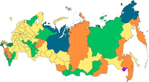
English: Copy of File:Map of federal subjects of Russia (2022).svg with disputed annexed Ukrainian territories indicated with diagonal stripes |
| Date | |
| Source |
This file was derived from: Map of federal subjects of Russia 2014, disputed Crimea.svg |
| Author | Mzajac, Ltbubbas |
.svg)
Licensing
This file is licensed under the Creative Commons Attribution-Share Alike 4.0 International license.
- You are free:
- to share – to copy, distribute and transmit the work
- to remix – to adapt the work
- Under the following conditions:
- attribution – You must give appropriate credit, provide a link to the license, and indicate if changes were made. You may do so in any reasonable manner, but not in any way that suggests the licensor endorses you or your use.
- share alike – If you remix, transform, or build upon the material, you must distribute your contributions under the same or compatible license as the original.
File history
Click on a date/time to view the file as it appeared at that time.
| Date/Time | Thumbnail | Dimensions | User | Comment | |
|---|---|---|---|---|---|
| current | 19:48, 4 October 2022 | | 512 × 282 (827 KB) | Techso01 | Uploaded a work by Mzajac, Ltbubbas from {{derived from|Map of federal subjects of Russia (2014), disputed Crimea.svg}} with UploadWizard |
File usage
The following pages on the English Wikipedia use this file (pages on other projects are not listed):
Global file usage
The following other wikis use this file:
- Usage on ab.wikipedia.org
- Usage on ar.wikipedia.org
- Usage on ast.wikipedia.org
- Usage on be.wikipedia.org
- Usage on cs.wikipedia.org
- Usage on de.wikipedia.org
- Usage on es.wikipedia.org
- Usage on fa.wikipedia.org
- Usage on fr.wikipedia.org
- Usage on is.wikipedia.org
- Usage on it.wikipedia.org
- Usage on ja.wikipedia.org
- Usage on ko.wikipedia.org
- Usage on la.wikipedia.org
- Usage on lez.wikipedia.org
- Usage on lld.wikipedia.org
- Usage on lt.wikipedia.org
- Usage on lv.wikipedia.org
- Usage on mi.wikipedia.org
- Usage on oc.wikipedia.org
- Usage on pt.wikipedia.org
- Usage on ru.wikipedia.org
- Usage on sl.wikipedia.org
- Usage on sr.wikipedia.org
- Usage on th.wikipedia.org
- Usage on tly.wikipedia.org
- Usage on tum.wikipedia.org
- Usage on uk.wikipedia.org
- Usage on uz.wikipedia.org
- Usage on vi.wikipedia.org
- Usage on vls.wikipedia.org
- Usage on zh.wikipedia.org
,_disputed_Crimea_and_Donbass.svg)