
File:Kenneth 2017-08-20 2156Z.jpg
Size of this preview: 450 × 600 pixels. Other resolutions: 180 × 240 pixels | 360 × 480 pixels | 576 × 768 pixels | 768 × 1,024 pixels | 1,536 × 2,048 pixels | 6,000 × 8,000 pixels.
Original file (6,000 × 8,000 pixels, file size: 8.17 MB, MIME type: image/jpeg)
| This is a file from the Wikimedia Commons. Information from its description page there is shown below. Commons is a freely licensed media file repository. You can help. |
Summary
| Description |
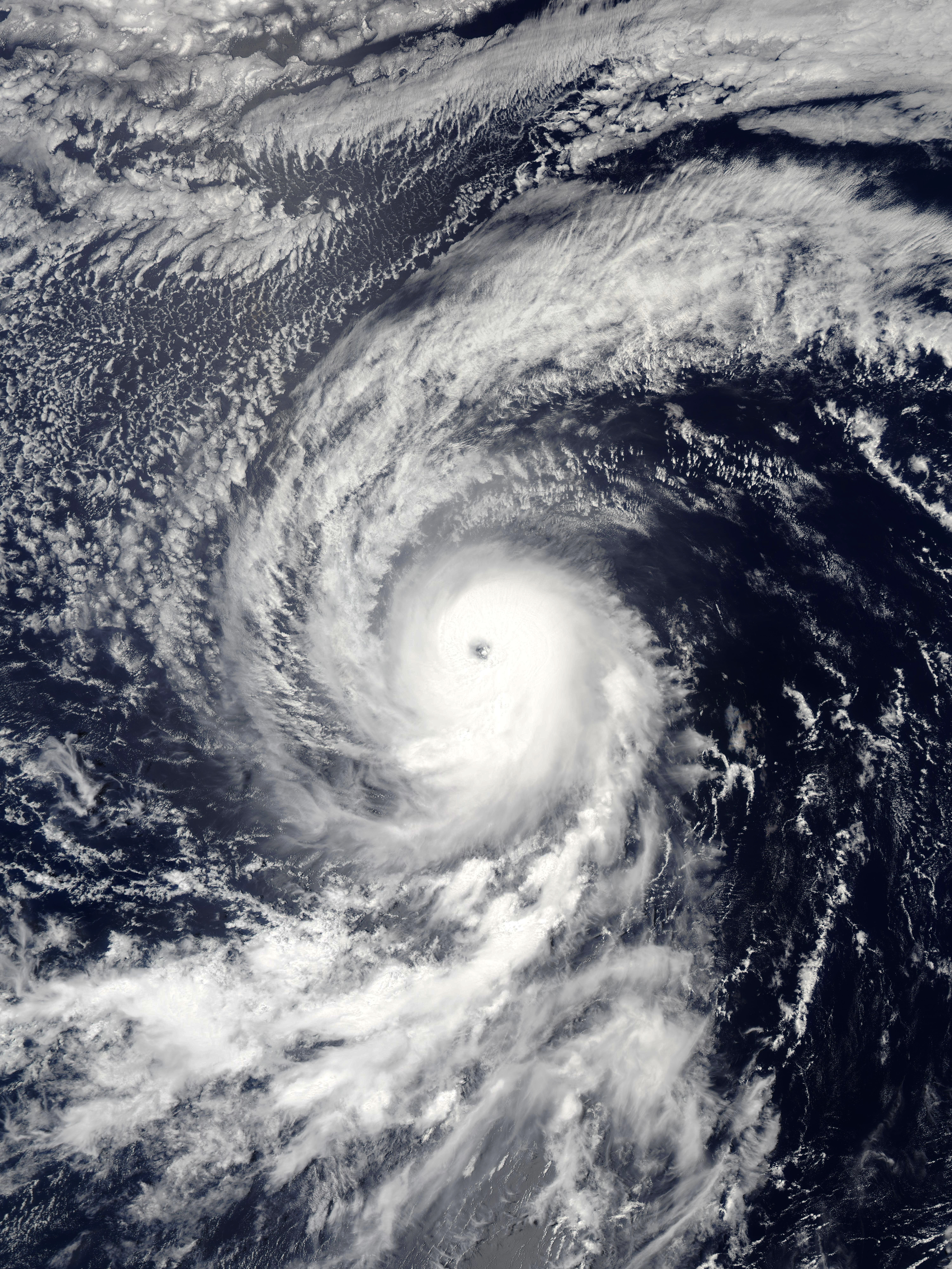
English: A satellite image of Hurricane Kenneth moving westwards over the eastern Pacific Ocean at 21:56 UTC on August 20 2017. The category 1 hurricane is rapidly strengthening, and sustained winds are 80 knots. |
| Date | |
| Source | NASA Worldview |
| Author | National Aeronautics and Space Administration (NASA) - 'Aqua' satellite |
| Camera location | | View this and other nearby images on: OpenStreetMap |
|---|
Licensing
| This file is in the public domain in the United States because it was solely created by NASA. NASA copyright policy states that "NASA material is not protected by copyright unless noted". (See Template:PD-USGov, NASA copyright policy page or JPL Image Use Policy.) | ||
 |
Warnings:
|
File history
Click on a date/time to view the file as it appeared at that time.
| Date/Time | Thumbnail | Dimensions | User | Comment | |
|---|---|---|---|---|---|
| current | 19:45, 9 November 2019 | | 6,000 × 8,000 (8.17 MB) | FleurDeOdile | gallery-like |
| 01:26, 5 November 2018 |  | 4,225 × 6,305 (3.36 MB) | Nino Marakot | Centered, lesser MBs | |
| 08:04, 21 August 2017 |  | 6,077 × 8,771 (10.54 MB) | ChocolateTrain | User created page with UploadWizard |
File usage
The following pages on the English Wikipedia use this file (pages on other projects are not listed):