
File:Kaimaumau landsat.jpg
No higher resolution available.
Kaimaumau_landsat.jpg (200 × 200 pixels, file size: 4 KB, MIME type: image/jpeg)
| This is a file from the Wikimedia Commons. Information from its description page there is shown below. Commons is a freely licensed media file repository. You can help. |
Summary
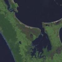
NASA World wind image of en:Kaimaumau wetland in New Zealand.

Licensing
| This image is in the public domain because it is a screenshot from NASA’s globe software World Wind using a public domain layer, such as Blue Marble, MODIS, Landsat, SRTM, USGS or GLOBE.
|
 |
derivative works
Derivative works of this file: 90mile beach nz landsatimage crop.jpg
File history
Click on a date/time to view the file as it appeared at that time.
| Date/Time | Thumbnail | Dimensions | User | Comment | |
|---|---|---|---|---|---|
| current | 04:27, 10 December 2018 | | 200 × 200 (4 KB) | Giantflightlessbirds | File:90mile beach nz landsatimage.jpg cropped 84 % horizontally, 79 % vertically using CropTool with precise mode. |
File usage
The following pages on the English Wikipedia use this file (pages on other projects are not listed):
Global file usage
The following other wikis use this file:
- Usage on es.wikipedia.org