
File:Georgia Guria relief location map.svg

Size of this PNG preview of this SVG file: 512 × 290 pixels. Other resolutions: 320 × 181 pixels | 640 × 363 pixels | 1,024 × 580 pixels | 1,280 × 725 pixels | 2,560 × 1,450 pixels.
Original file (SVG file, nominally 512 × 290 pixels, file size: 6.37 MB)
| This is a file from the Wikimedia Commons. Information from its description page there is shown below. Commons is a freely licensed media file repository. You can help. |
Summary
| Description |
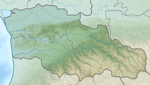
English: Guria region relief location map
ქართული: გურიის რეგიონის გეორეფერენსირებული რელიეფური რუკა
Equirectangular projection, N/S stretching 135 %. Geographic limits of the map:
|
||
| Date | |||
| Source | Own work | ||
| Author | Giorgi Balakhadze | ||
| Other versions |
|
||
| SVG | W3C-validity not checked. |


Licensing
Giorgi Balakhadze at Wikimedia Foundation, the copyright holder of this work, hereby publishes it under the following license:
This file is licensed under the Creative Commons Attribution-Share Alike 4.0 International license.
Attribution: Giorgi Balakhadze at Wikimedia Foundation
- You are free:
- to share – to copy, distribute and transmit the work
- to remix – to adapt the work
- Under the following conditions:
- attribution – You must give appropriate credit, provide a link to the license, and indicate if changes were made. You may do so in any reasonable manner, but not in any way that suggests the licensor endorses you or your use.
- share alike – If you remix, transform, or build upon the material, you must distribute your contributions under the same or compatible license as the original.
File history
Click on a date/time to view the file as it appeared at that time.
| Date/Time | Thumbnail | Dimensions | User | Comment | |
|---|---|---|---|---|---|
| current | 19:21, 12 February 2018 | | 512 × 290 (6.37 MB) | Giorgi Balakhadze | User created page with UploadWizard |
File usage
The following pages on the English Wikipedia use this file (pages on other projects are not listed):
Global file usage
The following other wikis use this file:
- Usage on ar.wikipedia.org
- Usage on ba.wikipedia.org
- Usage on ceb.wikipedia.org
- Usage on ce.wikipedia.org
- Usage on cs.wikipedia.org
- Usage on de.wikipedia.org
- Usage on eo.wikipedia.org
- Usage on es.wikipedia.org
- Usage on fa.wikipedia.org
- Usage on fr.wikipedia.org
- Usage on he.wikipedia.org
- Usage on hy.wikipedia.org
- Usage on id.wikipedia.org
- Usage on ka.wikipedia.org
- Usage on kn.wikipedia.org
- Usage on lv.wikipedia.org
- Usage on mdf.wikipedia.org
- Usage on nl.wikipedia.org
View more global usage of this file.