
File:County of Soissons (1180).png
No higher resolution available.
County_of_Soissons_(1180).png (427 × 398 pixels, file size: 107 KB, MIME type: image/png)
| This is a file from the Wikimedia Commons. Information from its description page there is shown below. Commons is a freely licensed media file repository. You can help. |
.png)
| Description |
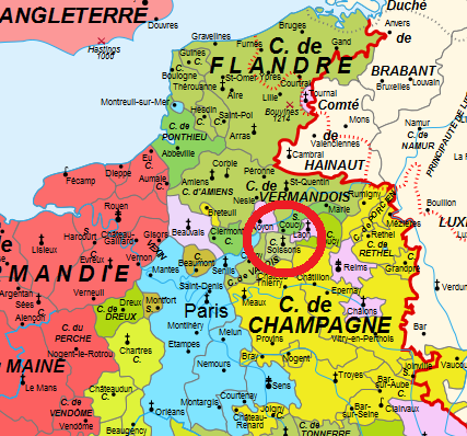
English: Map of the France in 1180 Français : Carte de la France en 1180 |
| Date | (UTC) |
| Source | |
| Author |
|
| This is a retouched picture, which means that it has been digitally altered from its original version. Modifications: cut off most of the map. Red circle around County of soissons. The original can be viewed here: Map France 1180-fr.svg:
|
I, the copyright holder of this work, hereby publish it under the following licenses:
This file is licensed under the Creative Commons Attribution-Share Alike 3.0 Unported, 2.5 Generic, 2.0 Generic and 1.0 Generic license.
- You are free:
- to share – to copy, distribute and transmit the work
- to remix – to adapt the work
- Under the following conditions:
- attribution – You must give appropriate credit, provide a link to the license, and indicate if changes were made. You may do so in any reasonable manner, but not in any way that suggests the licensor endorses you or your use.
- share alike – If you remix, transform, or build upon the material, you must distribute your contributions under the same or compatible license as the original.

|
Permission is granted to copy, distribute and/or modify this document under the terms of the GNU Free Documentation License, Version 1.2 or any later version published by the Free Software Foundation; with no Invariant Sections, no Front-Cover Texts, and no Back-Cover Texts. A copy of the license is included in the section entitled GNU Free Documentation License. |
You may select the license of your choice.
Original upload log
This image is a derivative work of the following images:
- File:Map_France_1180-fr.svg licensed with Cc-by-sa-3.0,2.5,2.0,1.0, GFDL
- 2009-01-09T11:35:35Z Zigeuner 988x1124 (1972311 Bytes) + seigneurie de Montpensier, couleur du Velay, vicomté de Marsan
- 2008-12-12T15:51:47Z Zigeuner 988x1124 (1970361 Bytes) Retour des limites d'arrière-fiefs dans le duché d'Aquitaine
- 2008-12-12T14:07:15Z Zigeuner 988x1124 (1970370 Bytes) + comté d'Alençon, seigneurie d'Harcourt (Normandie)
- 2008-12-06T15:42:18Z Zigeuner 988x1124 (1967888 Bytes) Tonnerre de la même couleur que Nevers et Auxerre
- 2008-12-05T22:43:51Z Zigeuner 988x1124 (1967902 Bytes) Couleurs identiques pour Flandres/Vermandois/Valois
- 2008-12-03T15:02:56Z Zigeuner 988x1124 (1966588 Bytes) {{Information |Description={{en|1=Map of the France in 1180}} {{fr|1=Carte de la France en 1180}} |Source=travail personnel (own work) |Author=[[User:Zigeuner|Zigeuner]] |Date=3 XII 2008 |Permission= |other_versions=Image:Map
Uploaded with derivativeFX
File history
Click on a date/time to view the file as it appeared at that time.
| Date/Time | Thumbnail | Dimensions | User | Comment | |
|---|---|---|---|---|---|
| current | 13:20, 7 April 2011 | | 427 × 398 (107 KB) | Tomás de Sousa Athayde e Noronha | {{Information |Description={{en|1=Map of the France in 1180}} {{fr|1=Carte de la France en 1180}} |Source=*File:Map_France_1180-fr.svg |Date=2011-04-07 13:18 (UTC) |Author=*File:Map_France_1180-fr.svg: Zigeuner *derivative wo |
File usage
The following pages on the English Wikipedia use this file (pages on other projects are not listed):
Global file usage
The following other wikis use this file:
- Usage on arz.wikipedia.org
- Usage on bg.wikipedia.org
- Usage on pt.wikipedia.org
- Usage on ru.wikipedia.org
.png)