
File:Copperas Hill station site geograph-3855414-by-Ben-Brooksbank.jpg
Size of this preview: 800 × 456 pixels. Other resolutions: 320 × 183 pixels | 640 × 365 pixels | 1,024 × 584 pixels | 1,280 × 730 pixels | 2,351 × 1,341 pixels.
Original file (2,351 × 1,341 pixels, file size: 3.35 MB, MIME type: image/jpeg)
| This is a file from the Wikimedia Commons. Information from its description page there is shown below. Commons is a freely licensed media file repository. You can help. |
Summary
| Description |
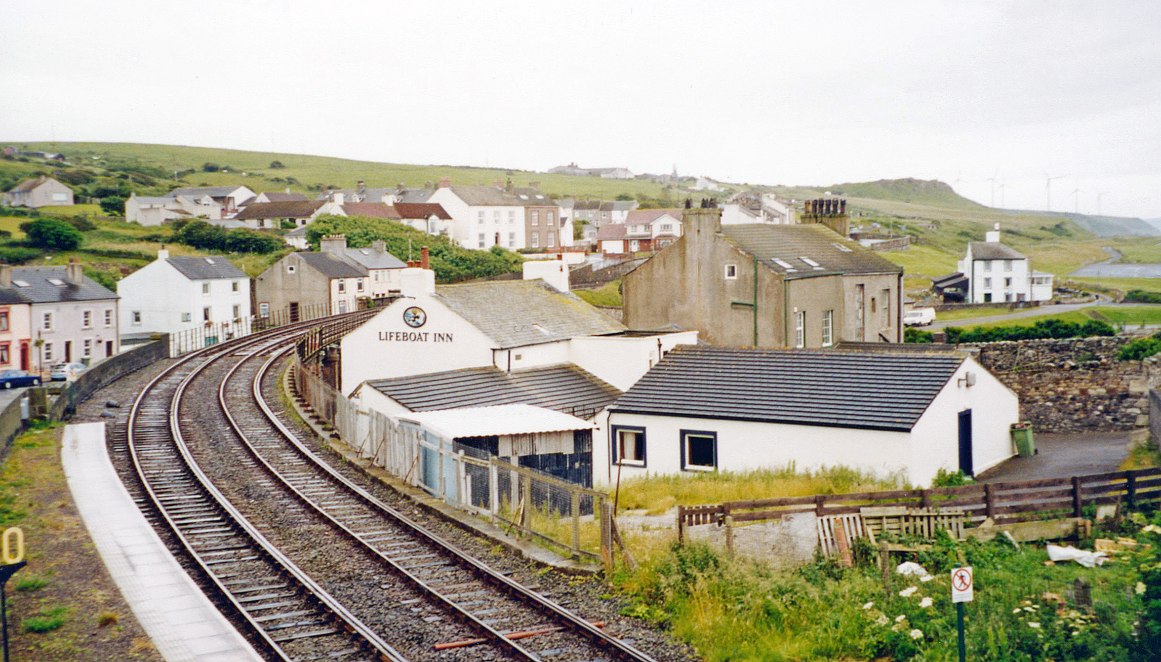
English: Site of former Copperas Hill station. View southward from Harrington station, to Copperas Hill on the ex-Harrington & Lowca Light Railway from Harrington Junction to Lowca - as steep as 1-in-17, closed to passengers 1/2/29, to freight much later. Nothing whatever of this Lowca branch is in fact visible, but merely the ex-LNWR (Carlisle) - Maryport - Workington - Whitehaven (Coast) line going south from Harrington station, below the hills showing scars of the former industrial landscape. |
| Date | |
| Source | From geograph.org.uk |
| Author | Ben Brooksbank |
| Permission (Reusing this file) |
Creative Commons Attribution Share-alike license 2.0 |
| Attribution (required by the license) | Ben Brooksbank / Site of former Copperas Hill station / |
| Camera location | | View this and other nearby images on: OpenStreetMap |
|---|
Licensing

|
This image was taken from the Geograph project collection. See this photograph's page on the Geograph website for the photographer's contact details. The copyright on this image is owned by Ben Brooksbank and is licensed for reuse under the Creative Commons Attribution-ShareAlike 2.0 license.
|
This file is licensed under the Creative Commons Attribution-Share Alike 2.0 Generic license.
Attribution: Ben Brooksbank
- You are free:
- to share – to copy, distribute and transmit the work
- to remix – to adapt the work
- Under the following conditions:
- attribution – You must give appropriate credit, provide a link to the license, and indicate if changes were made. You may do so in any reasonable manner, but not in any way that suggests the licensor endorses you or your use.
- share alike – If you remix, transform, or build upon the material, you must distribute your contributions under the same or compatible license as the original.
File history
Click on a date/time to view the file as it appeared at that time.
| Date/Time | Thumbnail | Dimensions | User | Comment | |
|---|---|---|---|---|---|
| current | 11:09, 21 March 2014 | | 2,351 × 1,341 (3.35 MB) | Chevin | == {{int:filedesc}} == {{Information |Description={{en|1='''Site of former Copperas Hill station.'''<br/> View southward from Harrington station, to Copperas Hill on the ex-Harrington & Lowca Light Railway from Harrington Junction to Lowca - as steep a... |
File usage
The following pages on the English Wikipedia use this file (pages on other projects are not listed):