
File:AS17-M-0443.jpg
Original file (1,012 × 1,012 pixels, file size: 258 KB, MIME type: image/jpeg)
| This is a file from the Wikimedia Commons. Information from its description page there is shown below. Commons is a freely licensed media file repository. You can help. |
Summary
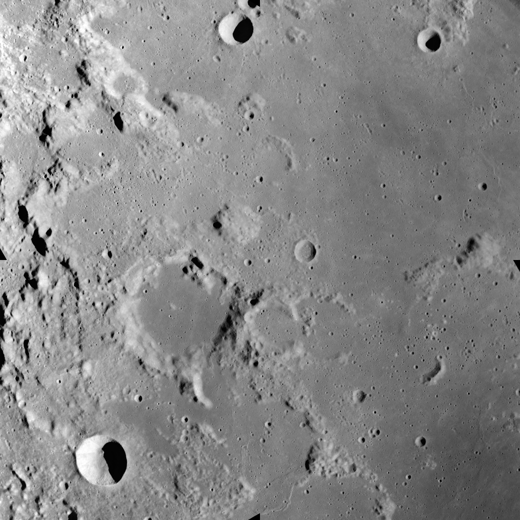
This image was taken during the Apollo 17 mapping metric sequence, revolution #14. The selenographic coordinates of this image are 20° N, 35.90° E.
At the center of this image is the dome-like Mons Maraldi, and just to the southwest is the flooded Maraldi crater. Most of the eastern half of this view is occupied by the Sinus Amoris, a lunar mare, and the flooded remnants of older formations. The bowl-shaped crater in the southwest corner is Gardner, and the cup-shaped crater at top-center is Franck.
This picture was produced by reducing a Hi-res image to 25% of full size, then rotating 90° counter-clockwise so that north is toward the top edge.
Source: Lunar & Planetary Institute, http://www.lpi.usra.edu/resources/apollo/frame/?AS17-M-0443 [1]
Licensing
| This file is in the public domain in the United States because it was solely created by NASA. NASA copyright policy states that "NASA material is not protected by copyright unless noted". (See Template:PD-USGov, NASA copyright policy page or JPL Image Use Policy.) | ||
 |
Warnings:
|
File history
Click on a date/time to view the file as it appeared at that time.
| Date/Time | Thumbnail | Dimensions | User | Comment | |
|---|---|---|---|---|---|
| current | 20:22, 19 June 2018 | | 1,012 × 1,012 (258 KB) | Jstuby | higher resolution, better quality, from ASU |
| 17:58, 27 January 2006 |  | 601 × 600 (90 KB) | RJHall | Maraldi crater and surroundings from Apollo 17. |
File usage
Global file usage
The following other wikis use this file:
- Usage on ca.wikipedia.org
- Usage on ce.wikipedia.org
- Usage on da.wikipedia.org
- Usage on de.wikipedia.org
- Usage on es.wikipedia.org
- Usage on fa.wikipedia.org
- Usage on fr.wikipedia.org
- Usage on io.wikipedia.org
- Usage on it.wikipedia.org
- Usage on lb.wikipedia.org
- Usage on pl.wikipedia.org
- Usage on ru.wikipedia.org
- Usage on sv.wikipedia.org
- Usage on tt.wikipedia.org
- Usage on www.wikidata.org
- Usage on zh.wikipedia.org