
File:1855 Colton Map or City Plan of Paris, France - Geographicus - Paris-c-55.jpg
Size of this preview: 734 × 600 pixels. Other resolutions: 294 × 240 pixels | 588 × 480 pixels | 940 × 768 pixels | 1,253 × 1,024 pixels | 2,507 × 2,048 pixels | 3,000 × 2,451 pixels.
Original file (3,000 × 2,451 pixels, file size: 2.84 MB, MIME type: image/jpeg)
| This is a file from the Wikimedia Commons. Information from its description page there is shown below. Commons is a freely licensed media file repository. You can help. |
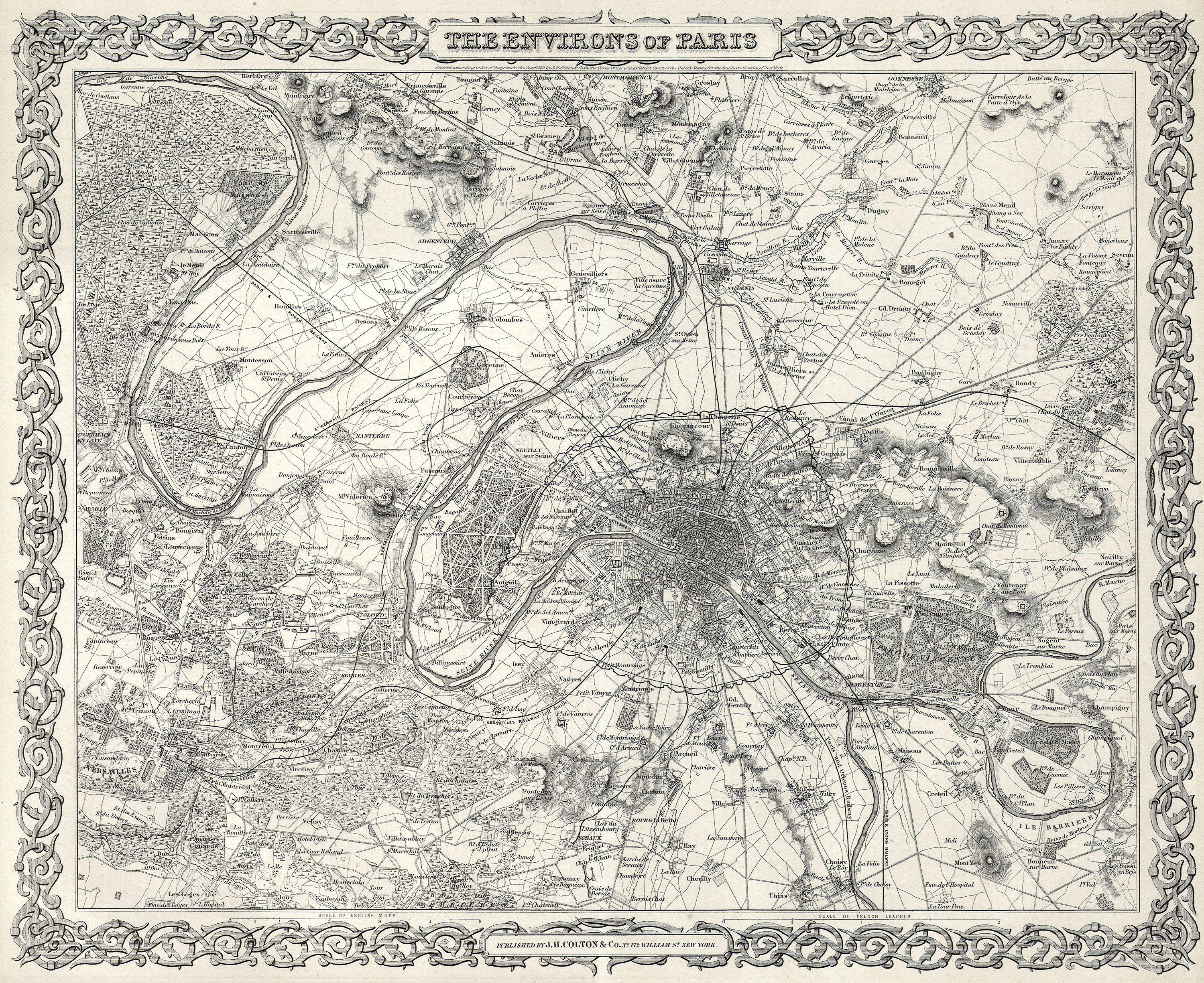
| J. H. Colton: The Environs of Paris
( |
|||||||||||||||||||||
|---|---|---|---|---|---|---|---|---|---|---|---|---|---|---|---|---|---|---|---|---|---|
| Artist |
|
||||||||||||||||||||
| Title |
The Environs of Paris |
||||||||||||||||||||
| Description |
English: This rare hand colored map of Paris and Environs is a copper plate engraving dating to 1855. Produced by the respected mid 19th century American Mapmaker J. H. Colton. Map covers the Seine valley in a roughly 30 mile radius of Paris. Versailles appears in the extreme southwest and Vitry in the extreme northeast. The whole is beautifully detailed down to individual buildings. A beautiful and superbly detailed map. |
||||||||||||||||||||
| Date | 1855 | ||||||||||||||||||||
| Dimensions | height: 13 in (33 cm); width: 16 in (40.6 cm) | ||||||||||||||||||||
| Accession number |
Geographicus link: Paris-c-55 |
||||||||||||||||||||
| Source/Photographer |
|
||||||||||||||||||||
| Permission (Reusing this file) |
|
||||||||||||||||||||

File history
Click on a date/time to view the file as it appeared at that time.
| Date/Time | Thumbnail | Dimensions | User | Comment | |
|---|---|---|---|---|---|
| current | 02:38, 25 March 2011 | | 3,000 × 2,451 (2.84 MB) | BotMultichillT | {{subst:User:Multichill/Geographicus |link=http://www.geographicus.com/P/AntiqueMap/Paris-c-55 |product_name=1855 Colton Map or City Plan of Paris, France |map_title=The Environs of Paris |description=This rare hand colored map of Paris and Environs is a |
File usage
The following pages on the English Wikipedia use this file (pages on other projects are not listed):
Global file usage
The following other wikis use this file:
- Usage on de.wikipedia.org
- Usage on fr.wikipedia.org